Motka
1633 BERMUDA MAP antique 18x22" by Henricus Hondius HAND COLORED
1633 BERMUDA MAP antique 18x22" by Henricus Hondius HAND COLORED
Regular price
$449.40 USD
Regular price
$642.00 USD
Sale price
$449.40 USD
Unit price
per
Couldn't load pickup availability
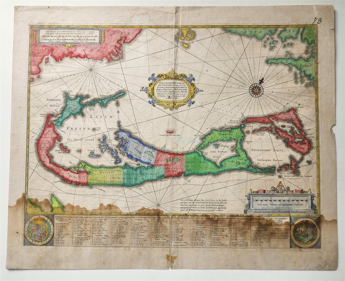
BERMUDA
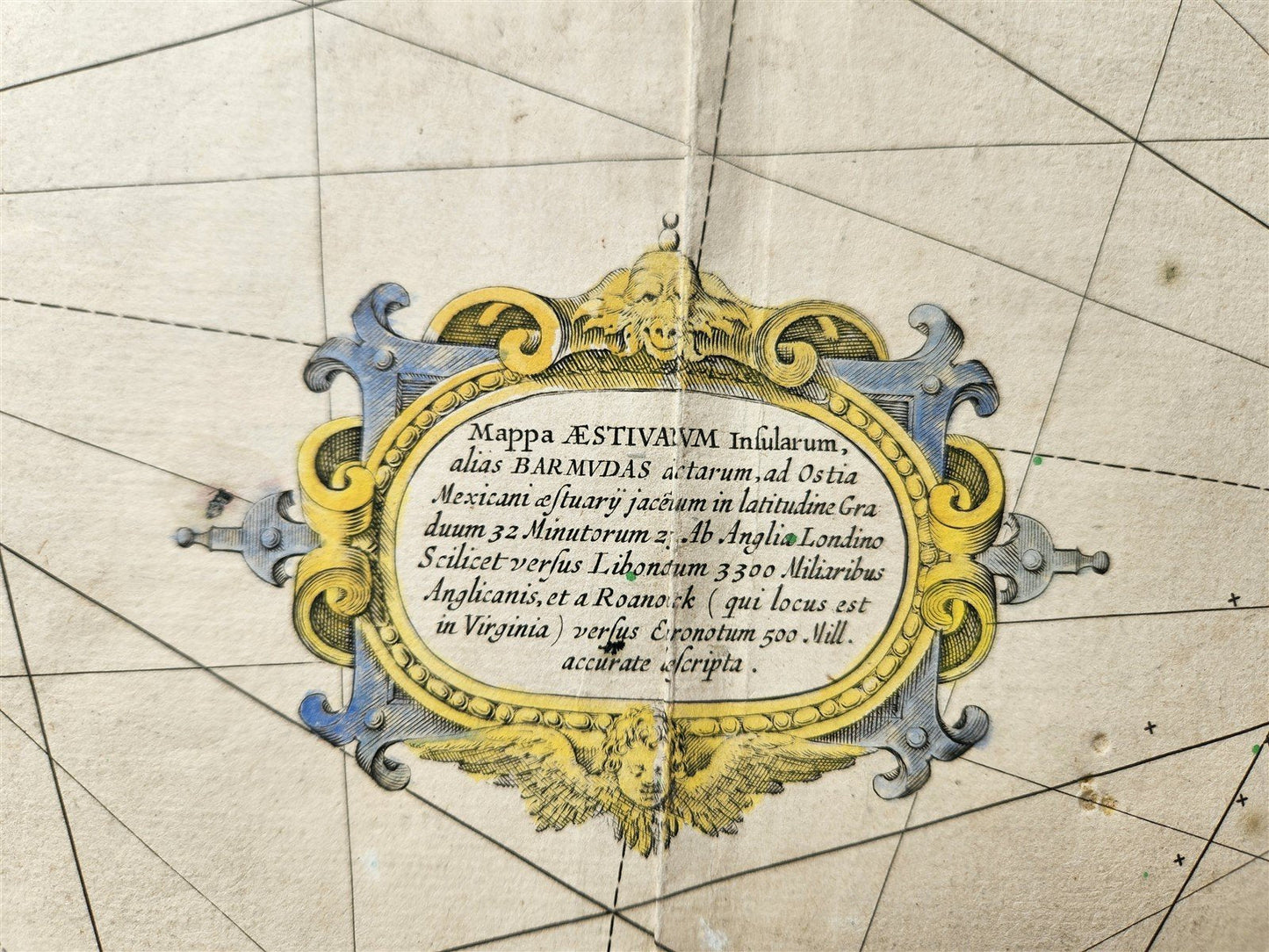
Mappa Aestivarum Insularum, alias Barmudas
c. 1633
Size about 15.5 BY 20.5 inches (18 by 22.5 inches with margins)
Hand colored
Dampstained
100% authentic
Henricus Hondius, a Dutch mapmaker, created a notable map of Bermuda titled "Mappa Aestivarum Insularum, alias Barmudas"
(Map of the Summer Isles, otherwise known as Bermuda)
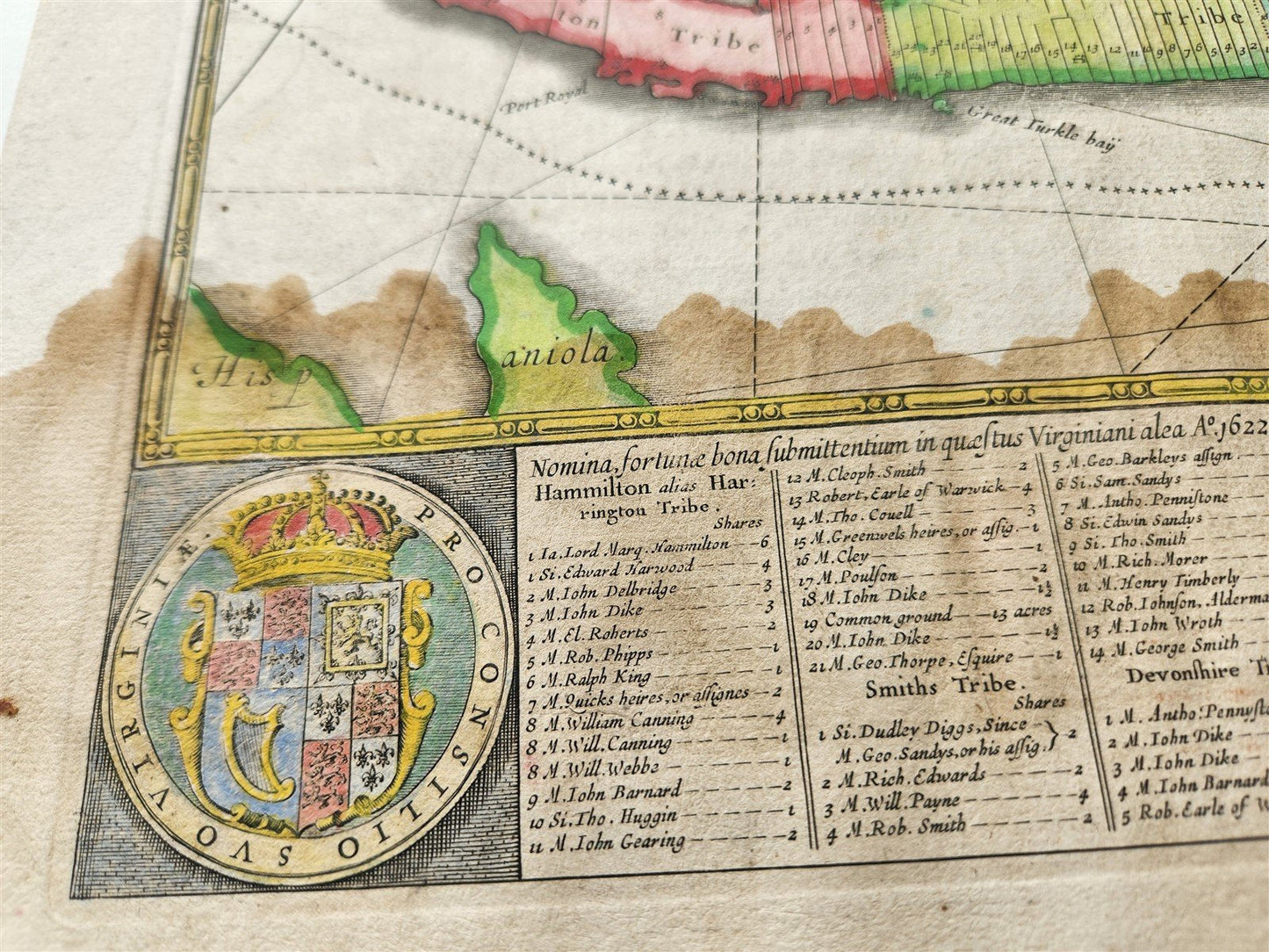
This map, first published around 1633, was based on earlier surveys by Richard Norwood and depicted the island with decorative elements and detailed property divisions.
It was a significant contribution to the understanding and representation of Bermuda in the 17th century.
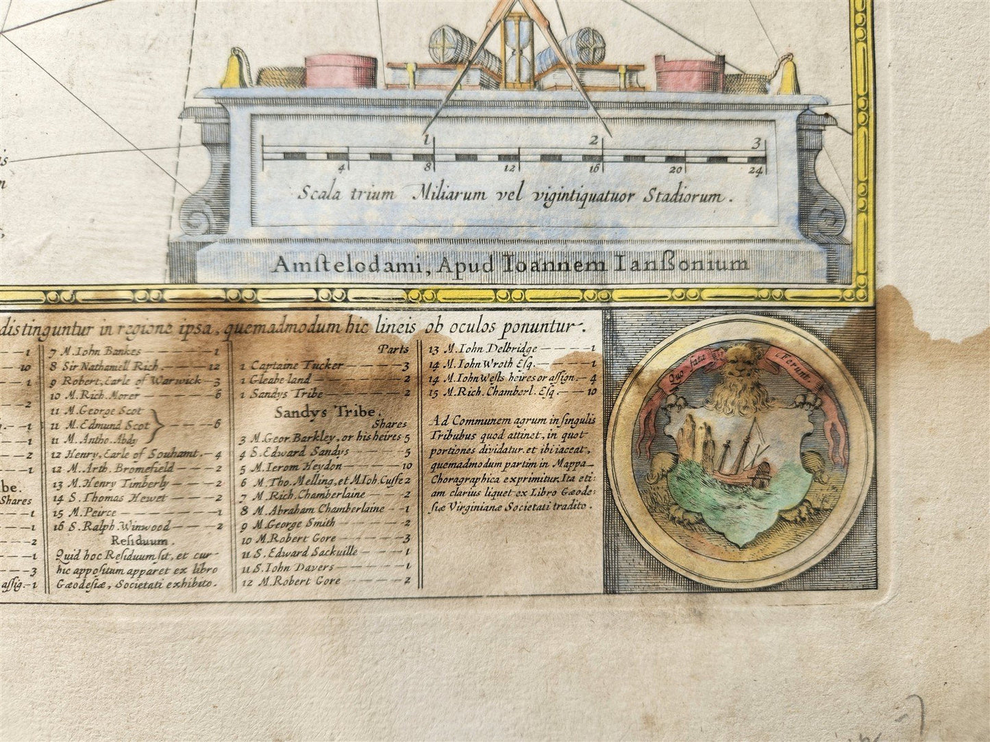
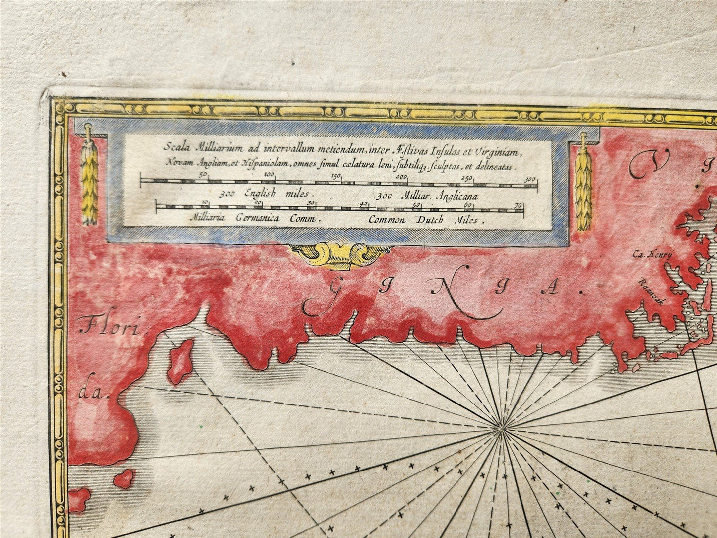
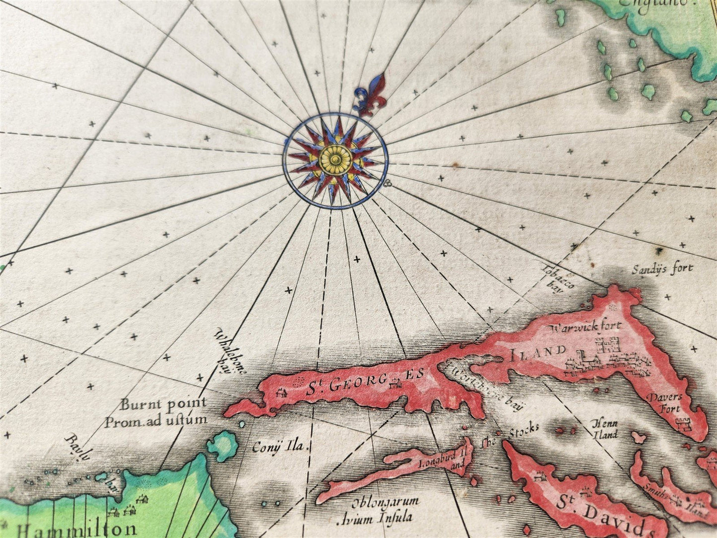
Hondius's "Mappa Aestivarum Insularum, alias Barmudas" is a double-page engraved map, known for its decorative cartouches, compass rose, and rhumb lines.
It shows the three main islands of Bermuda (Grand Bermuda, Somerset Island, and Saint George's Island).
The map is based on Richard Norwood's detailed survey of Bermuda, conducted in 1622, which was the first accurate mapping of the island.
Norwood's survey was commissioned by the Somer Island Company.
The map was first published in the German edition of Hondius's atlas, around 1633.
Later editions were included in various atlases, including those published by Janssonius and Valk & Schenk.
The map provides a glimpse into the early English settlement of Bermuda, as it shows the division of land into lots and tribes, along with a list of property owners. It also reflects the island's name change from "Bermudas" to "Somer Isles" (after Admiral George Somer), which was prevalent at the time.
===================================================
Please see my other auctions
Thank You
Refund Policy: We will issue a FULL REFUND, 100% money back if you are not satisfied with your purchase. Items must be returned to us within 20 days in order to receive a refund or replacement. Buyer is responsible for shipping costs.
Format: Atlas Map
Type: Physical Map
Date Range: 1700-1799
Original/Reproduction: Antique Original
Country/Region: Poland
Condition: Used Excellent
Format: Atlas Map
Type: Physical Map
Date Range: 1700-1799
Original/Reproduction: Antique Original
Country/Region: United States of America
Printing Technique: Lithography
Year: 1767
Condition: Used Excellent
Format: Atlas Map
Type: Physical Map
Date Range: 1600-1699
Original/Reproduction: Antique Original
Printing Technique: Lithography
Year: 1626
Condition: Used Excellent
Format: Atlas Map
Type: Physical Map
Date Range: 1600-1699
Original/Reproduction: Antique Original
Printing Technique: Lithography
Year: 1626
Condition: Used Excellent
Format: Atlas Map
Type: Physical Map
Date Range: 1600-1699
Original/Reproduction: Antique Original
Printing Technique: Lithography
Year: 1626
Condition: Used Excellent