Motka
1640 DUCHY of FLANDERS BELGIUM MAP by WILLEM BLAEU antique AUTHENTIC handcolored
1640 DUCHY of FLANDERS BELGIUM MAP by WILLEM BLAEU antique AUTHENTIC handcolored
Regular price
$200.90 USD
Regular price
$287.00 USD
Sale price
$200.90 USD
Unit price
per
Couldn't load pickup availability
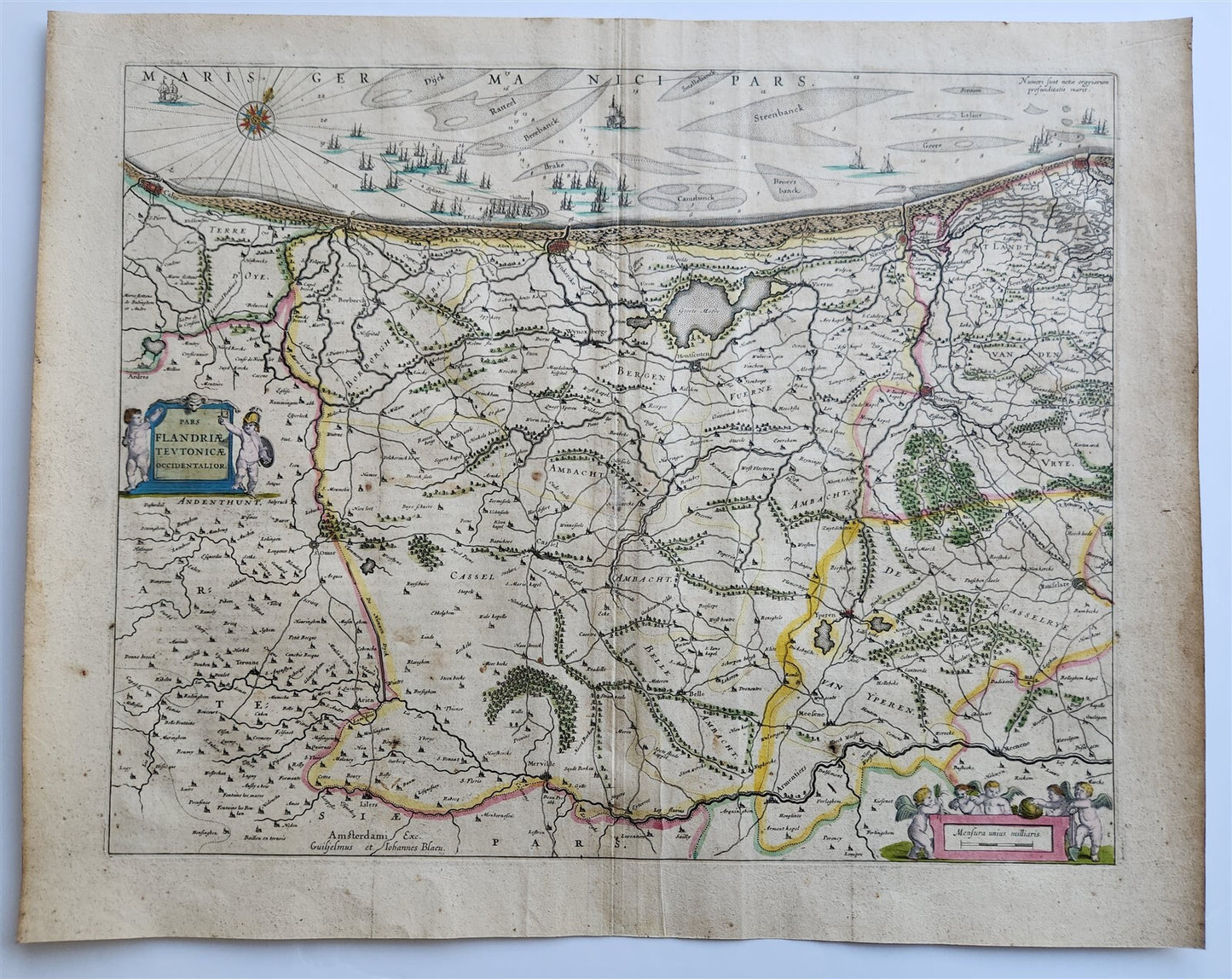
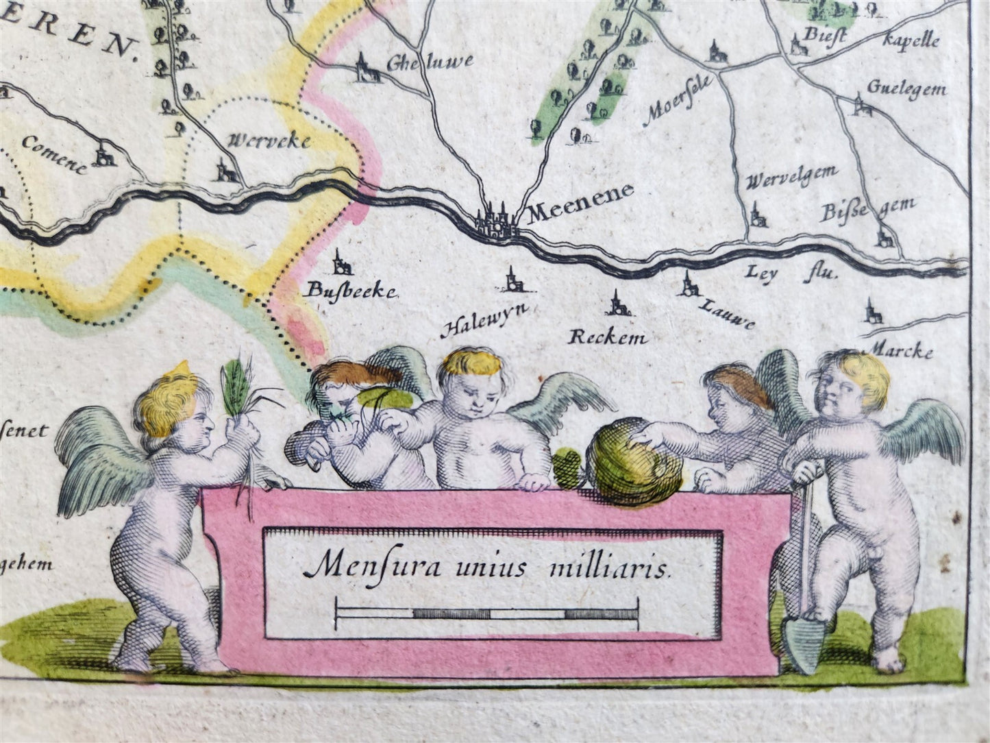
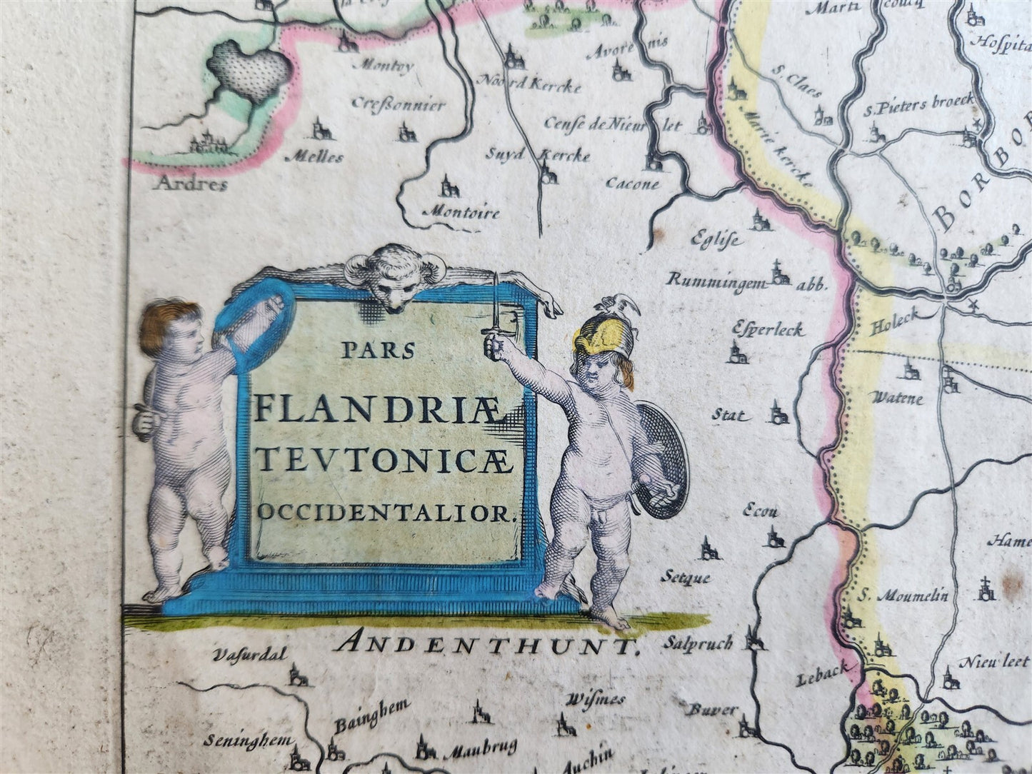
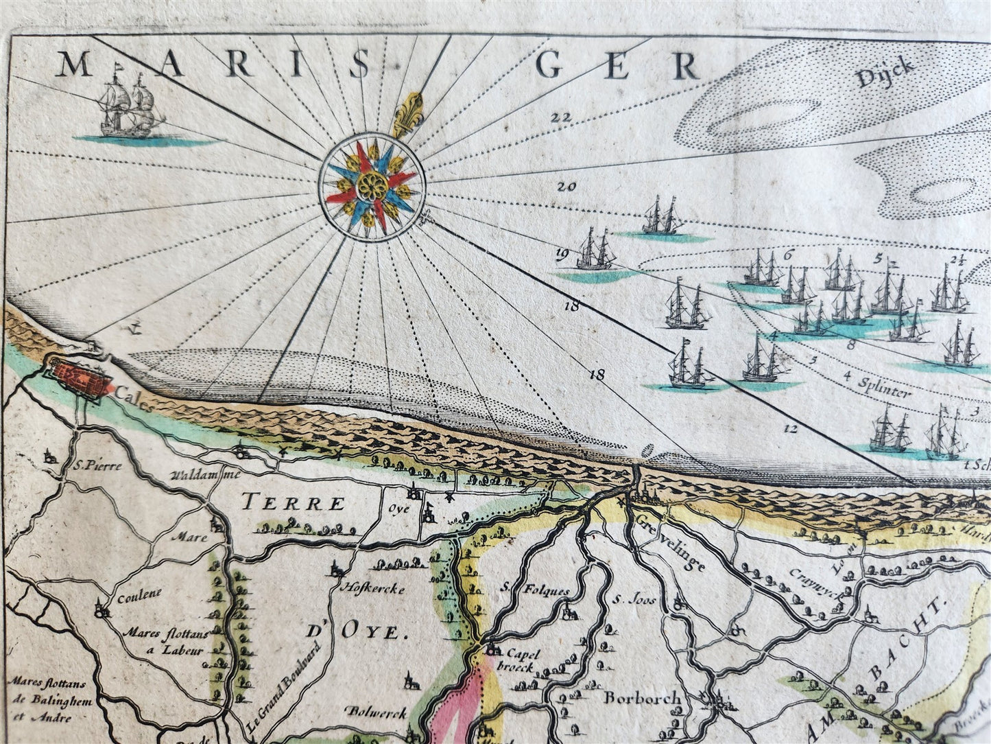
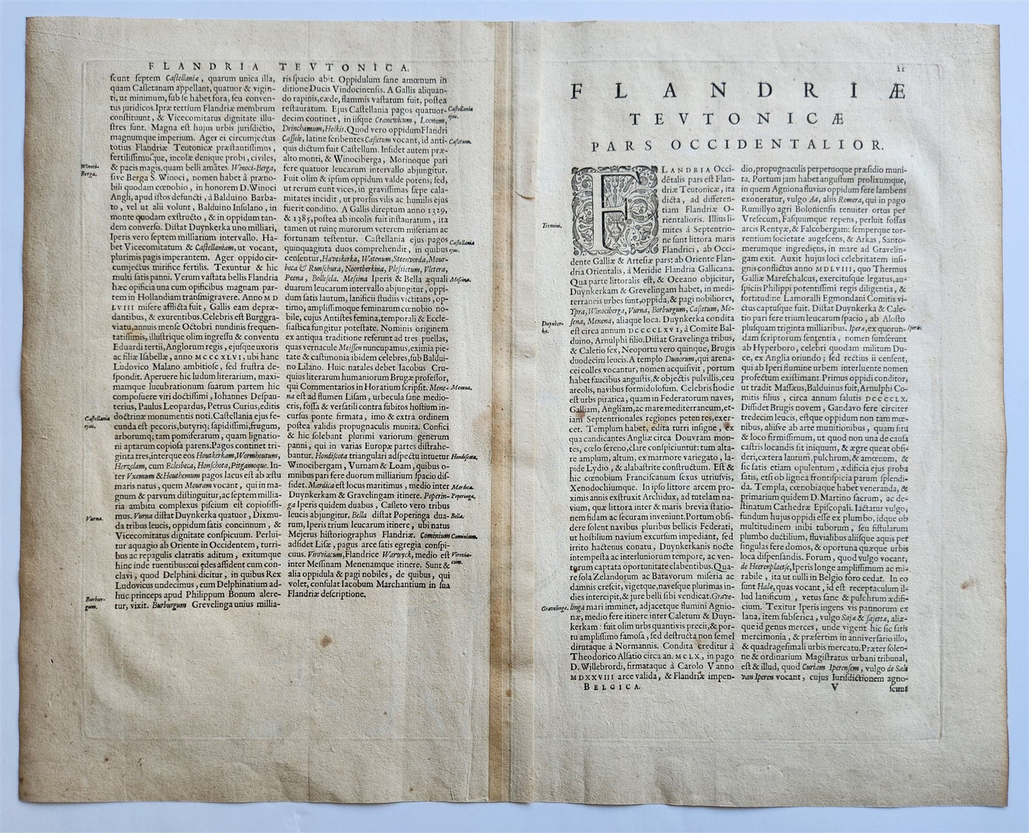
MAP FLANDRIA TEUTONICAE OCCIDENTALIORBELGIUMAmsterdam: Willem Blaeu; 1640. (from : Theatrum orbis terrarum, sive Atlas novus)"Flandriae Teutonicae Occidentalior" translates to "The Westerner part of Teutonic Flanders". The map depicts the Duchy of Flanders, with some parts now located in France.It's a detailed representation of the coastline and a portion of ZeelandHand coloredOverall 18 by 22 3/4 inches good condition, some wear100% authentic=========================================Please see my other auctions Thank You
Refund Policy: We will issue a FULL REFUND, 100% money back if you are not satisfied with your purchase. Items must be returned to us within 20 days in order to receive a refund or replacement. Buyer is responsible for shipping costs.
---------------------------------------------------------------------------------------------------------------------------------------------------------------------------------------------------------------------------------------------------------------------------------------------------------------------------------------------------------------------------------------------------------------------------------------------------------------------------------------------------------------------------------------------------------------------------------------------------------------------------------------------------------------------------------------------------------------------------------------------------------------------------------------------------------------------------------
MAP FLANDRIA TEUTONICAE OCCIDENTALIORBELGIUMAmsterdam: Willem Blaeu; 1640. (from : Theatrum orbis terrarum, sive Atlas novus)"Flandriae Teutonicae Occidentalior" translates to "The Westerner part of Teutonic Flanders". The map depicts the Duchy of Flanders, with some parts now located in France.It's a detailed representation of the coastline and a portion of ZeelandHand coloredOverall 18 by 22 3/4 inches good condition, some wear100% authentic
--------------------------------------------------------------------------------------------------------------------------------------------------------------------------------------------------------------------------------------------------------------------------------------------------------------------------------------------------------------------------------------------------------------------------------------------------------------------------------------------------
MAP
FLANDRIA TEUTONICAE OCCIDENTALIOR
BELGIUM
Amsterdam: Willem Blaeu; 1640.
(from : Theatrum orbis terrarum, sive Atlas novus)
"Flandriae Teutonicae Occidentalior" translates to "The Westerner part of Teutonic Flanders".
The map depicts the Duchy of Flanders, with some parts now located in France.
It's a detailed representation of the coastline and a portion of Zeeland
Hand colored
Overall 18 by 22 3/4 inches
good condition, some wear
100% authentic
=========================================
Please see my other auctions
Thank You
Refund Policy: We will issue a FULL REFUND, 100% money back if you are not satisfied with your purchase. Items must be returned to us within 20 days in order to receive a refund or replacement. Buyer is responsible for shipping costs.
Powered by SixBit's eCommerce Solution
View full details
- Country/Region:Belgium
- Date Range:1600-1699
- Original/Reproduction:Antique Original
- Type:Topographical Map
- Year:1640