Motka
1640 MAP of FRANCE FLANDERS by WILLEM BLAEU antique AUTHENTIC hand colored
1640 MAP of FRANCE FLANDERS by WILLEM BLAEU antique AUTHENTIC hand colored
Regular price
$200.90 USD
Regular price
$287.00 USD
Sale price
$200.90 USD
Unit price
per
Couldn't load pickup availability
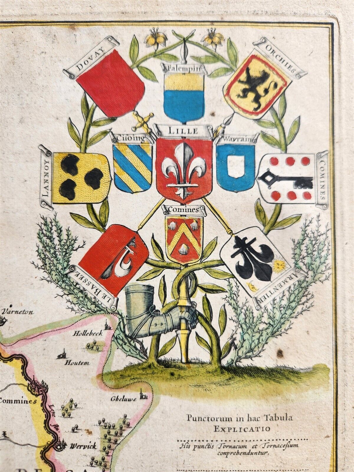
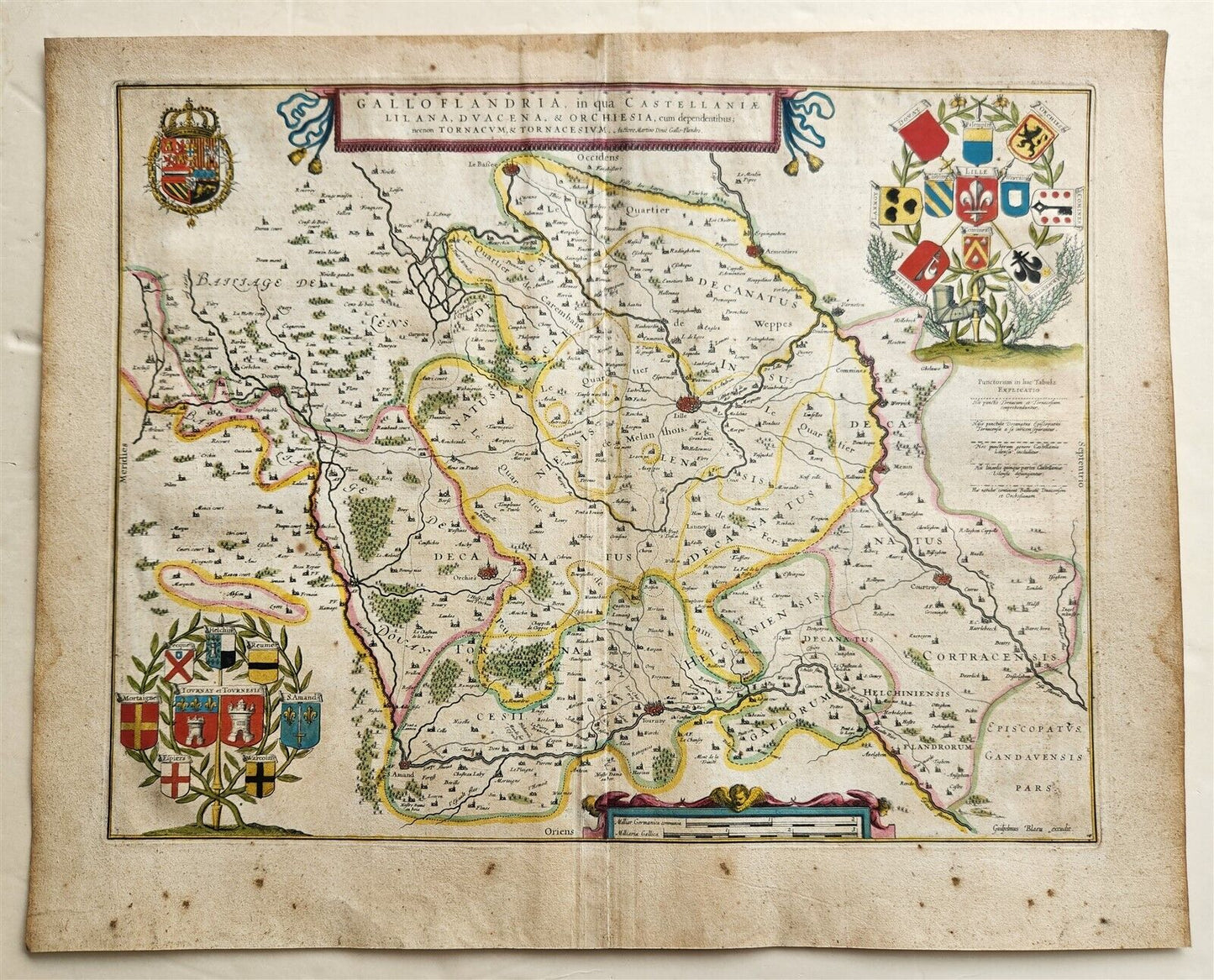
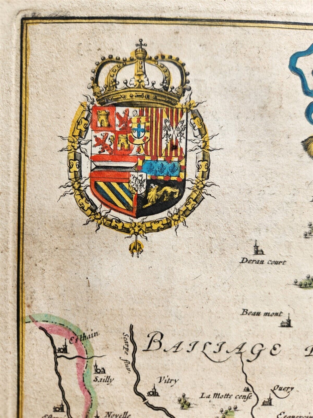
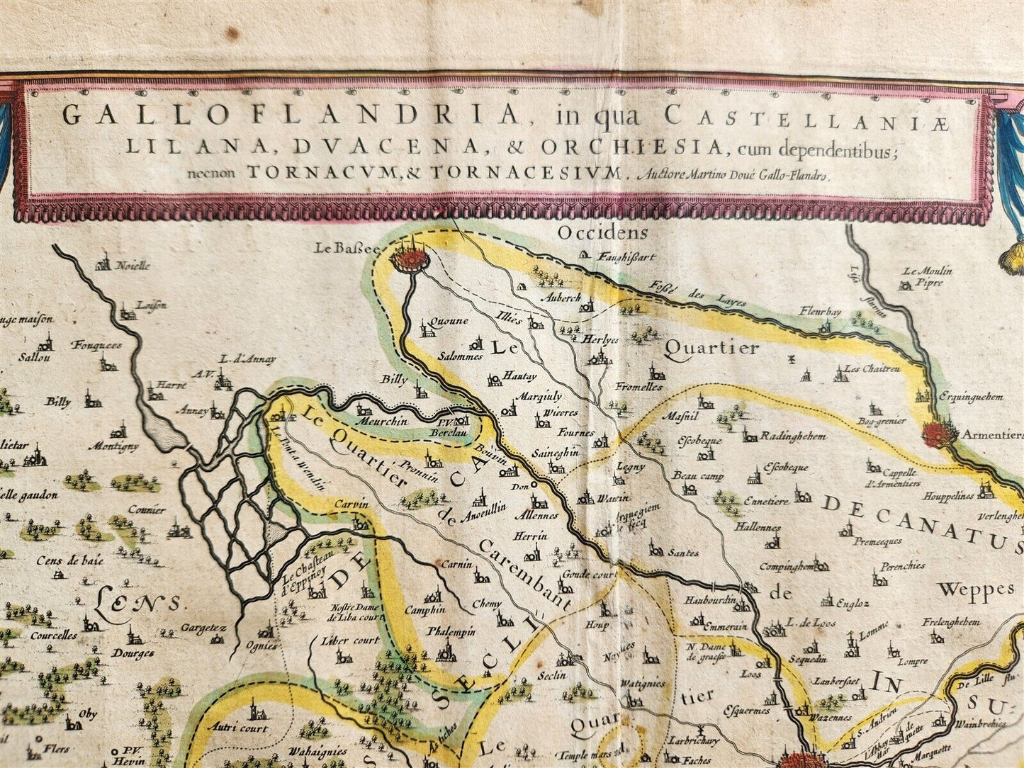
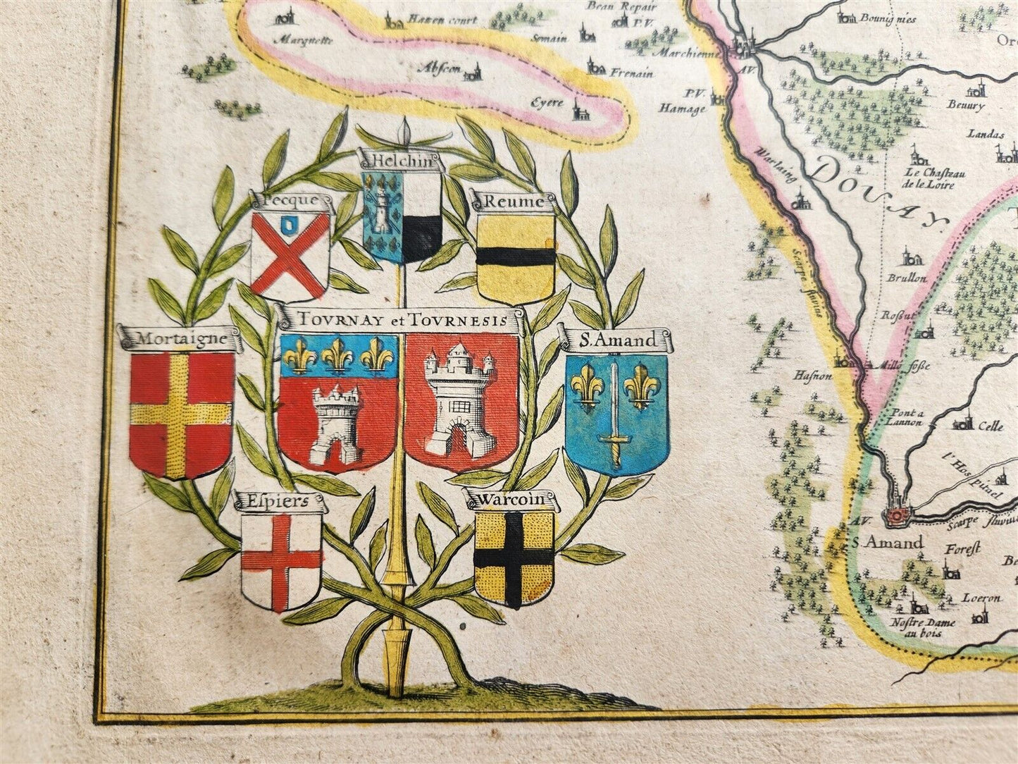
MAP GALLO FLANDRIA in qua CASTELLANIAEAmsterdam: Willem Blaeu; 1640. (from : Theatrum orbis terrarum, sive Atlas novus)Map of FRANCE:French Flanders, specifically focusing on the Castellaniae (counties or districts) of Lilla (Lille), Douai (Douacena), and Orchies (Orchiesia), along with their dependencies, and including Tournai (Tornacum) and its surrounding area (Tornacesium). Hand coloredSize of the plate 15 by 19.5 inchesOverall 18.5 by 22.5 inches good condition, some spots at the margins100% authentic=========================================Please see my other auctions Thank You
Refund Policy: We will issue a FULL REFUND, 100% money back if you are not satisfied with your purchase. Items must be returned to us within 20 days in order to receive a refund or replacement. Buyer is responsible for shipping costs.
------------------------------------------------------------------------------------------------------------------------------------------------------------------------------------------------------------------------------------------------------------------------------------------------------------------------------------------------------------------------------------------------------------------------------------------------------------------------------------------------------------------------------------------------------------------------------------------------------------------------------------------------------------------------------------------------------------------------------------------------------------------------------------------------------------------------------------------------------------------------------------------------------------
MAP GALLO FLANDRIA in qua CASTELLANIAEAmsterdam: Willem Blaeu; 1640. (from : Theatrum orbis terrarum, sive Atlas novus)Map of FRANCE:French Flanders, specifically focusing on the Castellaniae (counties or districts) of Lilla (Lille), Douai (Douacena), and Orchies (Orchiesia), along with their dependencies, and including Tournai (Tornacum) and its surrounding area (Tornacesium). Hand coloredSize of the plate 15 by 19.5 inchesOverall 18.5 by 22.5 inches good condition, some spots at the margins100% authentic
-----------------------------------------------------------------------------------------------------------------------------------------------------------------------------------------------------------------------------------------------------------------------------------------------------------------------------------------------------------------------------------------------------------------------------------------------------------------------------------------------------------------------------------------------------------------------------
MAP
GALLO FLANDRIA in qua CASTELLANIAE
Amsterdam: Willem Blaeu; 1640.
(from : Theatrum orbis terrarum, sive Atlas novus)
Map of FRANCE:
French Flanders, specifically focusing on the Castellaniae (counties or districts) of Lilla (Lille), Douai (Douacena), and Orchies (Orchiesia), along with their dependencies, and including Tournai (Tornacum) and its surrounding area (Tornacesium).
Hand colored
Size of the plate 15 by 19.5 inches
Overall 18.5 by 22.5 inches
good condition, some spots at the margins
100% authentic
=========================================
Please see my other auctions
Thank You
Refund Policy: We will issue a FULL REFUND, 100% money back if you are not satisfied with your purchase. Items must be returned to us within 20 days in order to receive a refund or replacement. Buyer is responsible for shipping costs.
Powered by SixBit's eCommerce Solution
View full details
- Country/Region:France
- Date Range:1600-1699
- Type:Topographical Map