Motka
1640 MAP of FRANCE LIONNOIS FOREST by WILLEM BLAEU antique AUTHENTIC handcolored
1640 MAP of FRANCE LIONNOIS FOREST by WILLEM BLAEU antique AUTHENTIC handcolored
Regular price
$200.90 USD
Regular price
$287.00 USD
Sale price
$200.90 USD
Unit price
per
Couldn't load pickup availability
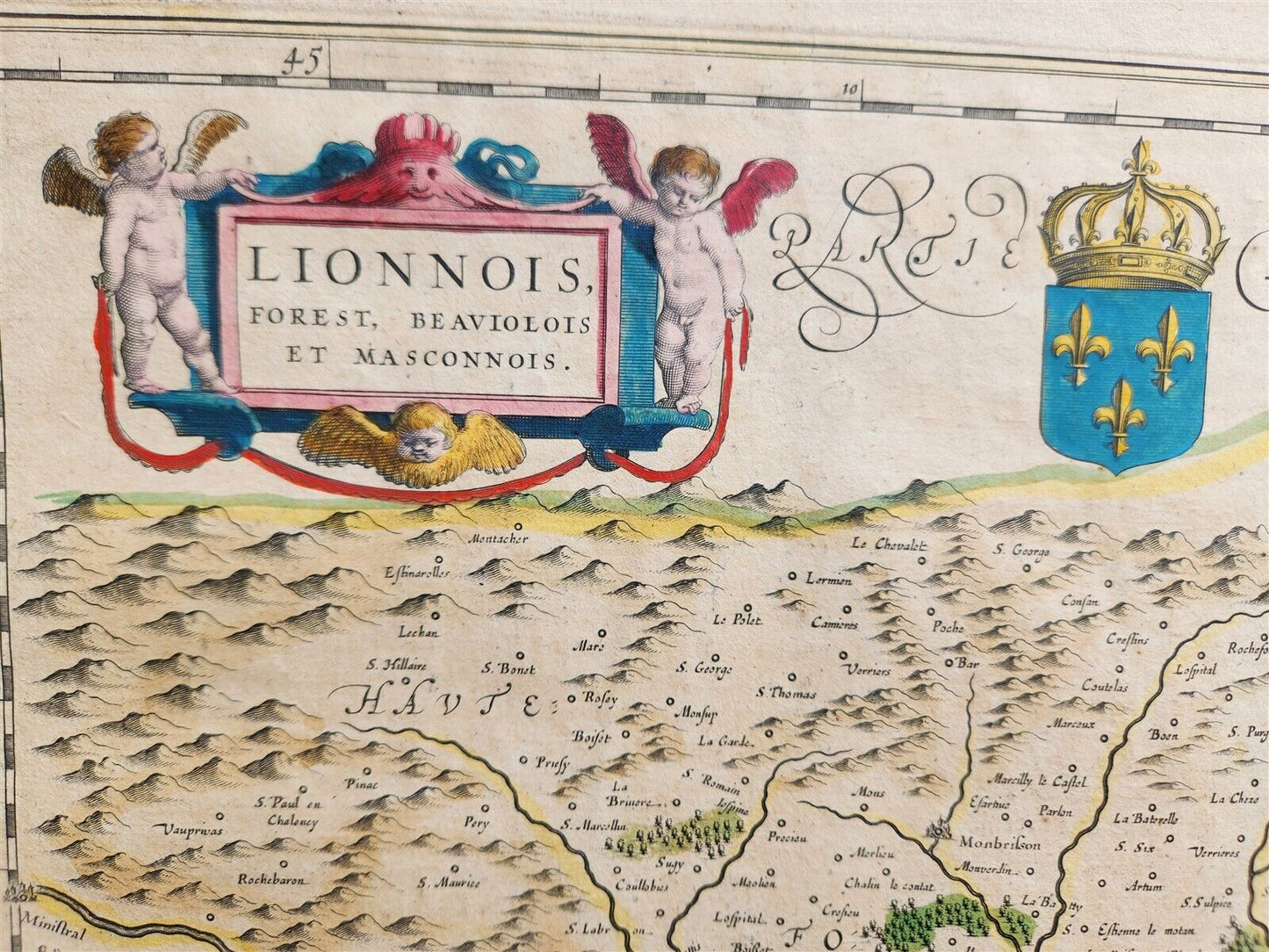
MAP LIONNOIS, FOREST, BEAVIOLOIS et MASCONNOISAmsterdam: Willem Blaeu; 1640. (from : Theatrum orbis terrarum, sive Atlas novus)Map of FRANCE:former province of Dauphine in southeastern France, which is also known as "Delphinatus" in Latin. Hand coloredSize of the plate 15 by 19 inchesOverall 18.5 by 22.5 inchesVery good condition100% authentic=========================================Please see my other auctions Thank You
Refund Policy: We will issue a FULL REFUND, 100% money back if you are not satisfied with your purchase. Items must be returned to us within 20 days in order to receive a refund or replacement. Buyer is responsible for shipping costs.
---------------------------------------------------------------------------------------------------------------------------------------------------------------------------------------------------------------------------------------------------------------------------------------------------------------------------------------------------------------------------------------------------------------------------------------------------------------------------------------------------------------------------------------------------------------------------------------------------------------------------------------------------------------------------------------------------------------------------------
MAP LIONNOIS, FOREST, BEAVIOLOIS et MASCONNOISAmsterdam: Willem Blaeu; 1640. (from : Theatrum orbis terrarum, sive Atlas novus)Map of FRANCE:former province of Dauphine in southeastern France, which is also known as "Delphinatus" in Latin. Hand coloredSize of the plate 15 by 19 inchesOverall 18.5 by 22.5 inchesVery good condition100% authentic
--------------------------------------------------------------------------------------------------------------------------------------------------------------------------------------------------------------------------------------------------------------------------------------------------------------------------------------------------------------------------------------------------
MAP
LIONNOIS, FOREST, BEAVIOLOIS et MASCONNOIS
Amsterdam: Willem Blaeu; 1640.
(from : Theatrum orbis terrarum, sive Atlas novus)
Map of FRANCE:
former province of Dauphine in southeastern France, which is also known as "Delphinatus" in Latin.
Hand colored
Size of the plate 15 by 19 inches
Overall 18.5 by 22.5 inches
Very good condition
100% authentic
=========================================
Please see my other auctions
Thank You
Refund Policy: We will issue a FULL REFUND, 100% money back if you are not satisfied with your purchase. Items must be returned to us within 20 days in order to receive a refund or replacement. Buyer is responsible for shipping costs.
Powered by SixBit's eCommerce Solution
View full details
- Country/Region:France
- Date Range:1600-1699
- Type:Topographical Map