Motka
1640 MAP of FRANCE Longpendu Charolais by WILLEM BLAEU antique AUTHENTIC
1640 MAP of FRANCE Longpendu Charolais by WILLEM BLAEU antique AUTHENTIC
Regular price
$200.90 USD
Regular price
$287.00 USD
Sale price
$200.90 USD
Unit price
per
Couldn't load pickup availability
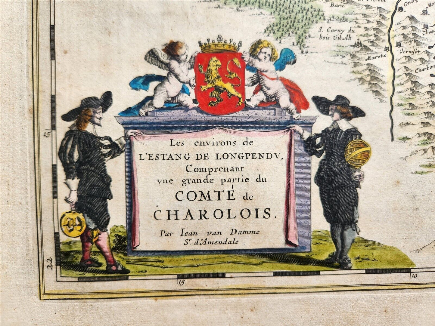
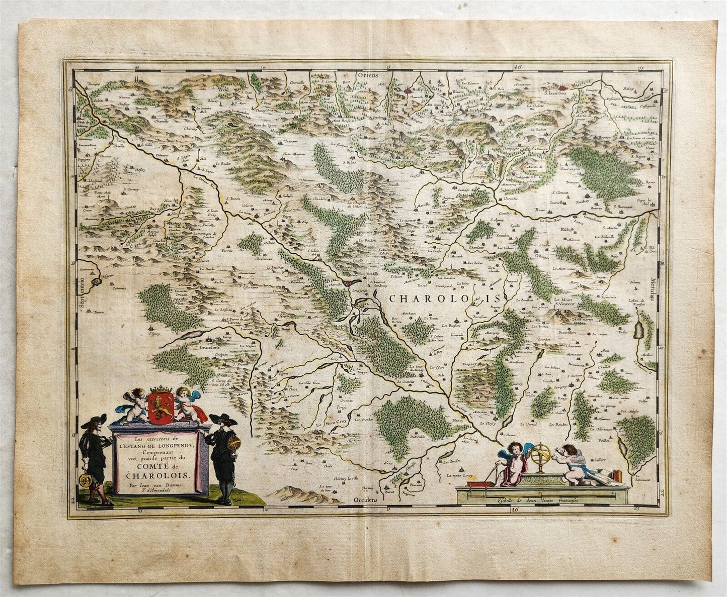
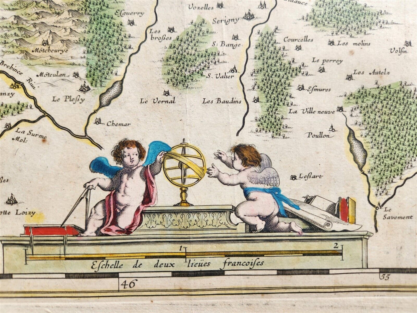
MAP Les environs de l'estang de Longpendu comprenant une grande partie du COMTE DE CHAROLOIS par Iean van Damme Sr. d'Amendale.Amsterdam: Willem Blaeu; 1640. (from : Theatrum orbis terrarum, sive Atlas novus)Map of France: Longpendu (Charolais)Plate size 14 3/4 by 19 1/2 inches (overall 18 1/2 by 22 1/2 inches)Hand coloredVery good condition100% authentic=========================================Please see my other auctions Thank You
Refund Policy: We will issue a FULL REFUND, 100% money back if you are not satisfied with your purchase. Items must be returned to us within 20 days in order to receive a refund or replacement. Buyer is responsible for shipping costs.
--------------------------------------------------------------------------------------------------------------------------------------------------------------------------------------------------------------------------------------------------------------------------------------------------------------------------------------------------------------------------------------------------------------------------------------------------------------------------------------------------------------------------------------------------------------------------------------------------------------------------------------------------------------------------------------------------------------
MAP Les environs de l'estang de Longpendu comprenant une grande partie du COMTE DE CHAROLOIS par Iean van Damme Sr. d'Amendale.Amsterdam: Willem Blaeu; 1640. (from : Theatrum orbis terrarum, sive Atlas novus)Map of France: Longpendu (Charolais)Plate size 14 3/4 by 19 1/2 inches (overall 18 1/2 by 22 1/2 inches)Hand coloredVery good condition100% authentic
-------------------------------------------------------------------------------------------------------------------------------------------------------------------------------------------------------------------------------------------------------------------------------------------------------------------------------------------------------------------------------
MAP
Les environs de l'estang de Longpendu comprenant une grande partie du COMTE DE CHAROLOIS
par Iean van Damme Sr. d'Amendale.
Amsterdam: Willem Blaeu; 1640.
(from : Theatrum orbis terrarum, sive Atlas novus)
Map of France:
Longpendu (Charolais)
Plate size 14 3/4 by 19 1/2 inches (overall 18 1/2 by 22 1/2 inches)
Hand colored
Very good condition
100% authentic
=========================================
Please see my other auctions
Thank You
Refund Policy: We will issue a FULL REFUND, 100% money back if you are not satisfied with your purchase. Items must be returned to us within 20 days in order to receive a refund or replacement. Buyer is responsible for shipping costs.
Powered by SixBit's eCommerce Solution
View full details
- Country/Region:France
- Date Range:1600-1699
- Type:Topographical Map