Motka
1640 MAP of GERMANY FOSSA SANCTAE MARIAE by WILLEM BLAEU antique AUTHENTIC
1640 MAP of GERMANY FOSSA SANCTAE MARIAE by WILLEM BLAEU antique AUTHENTIC
Regular price
$200.90 USD
Regular price
$287.00 USD
Sale price
$200.90 USD
Unit price
per
Couldn't load pickup availability
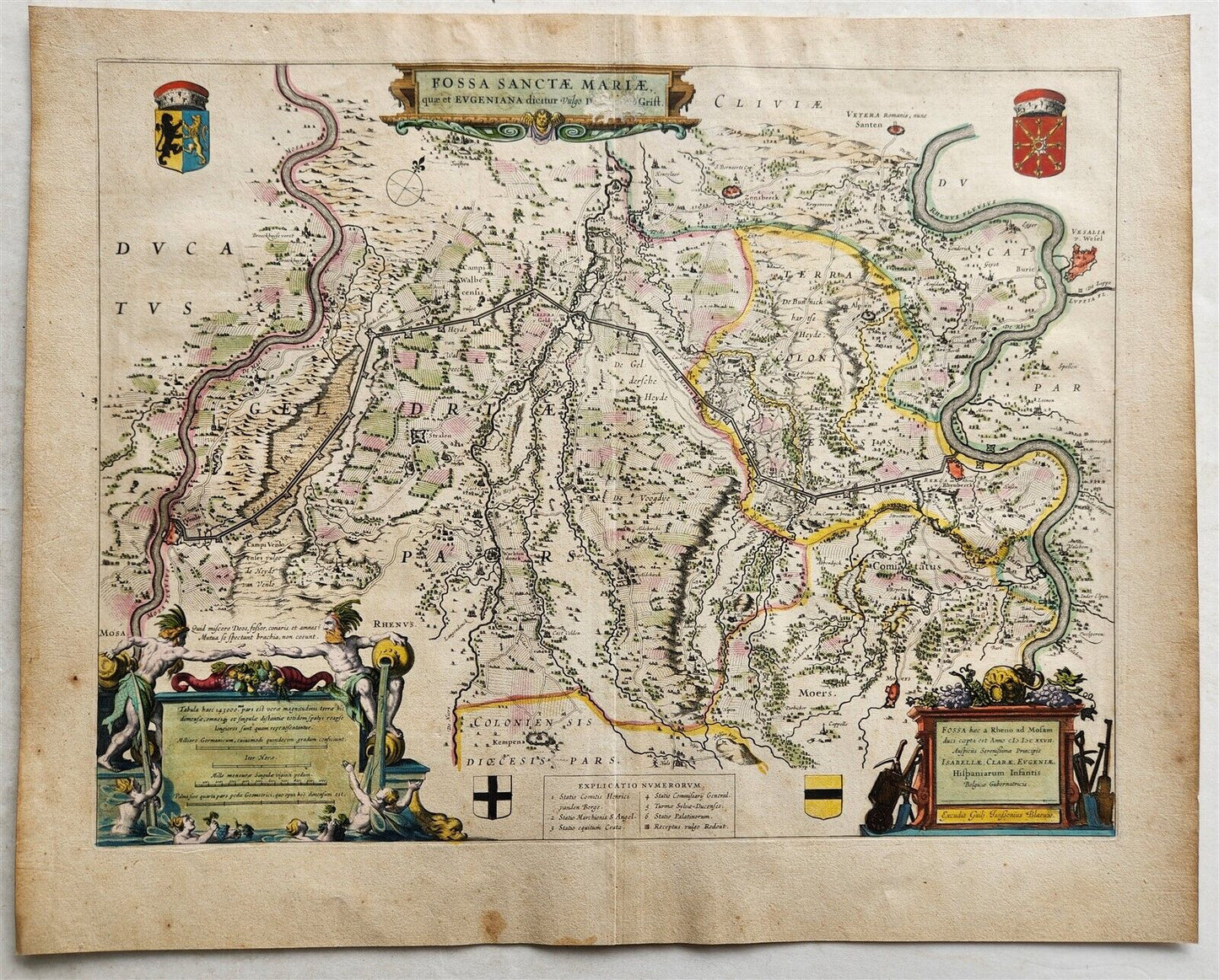
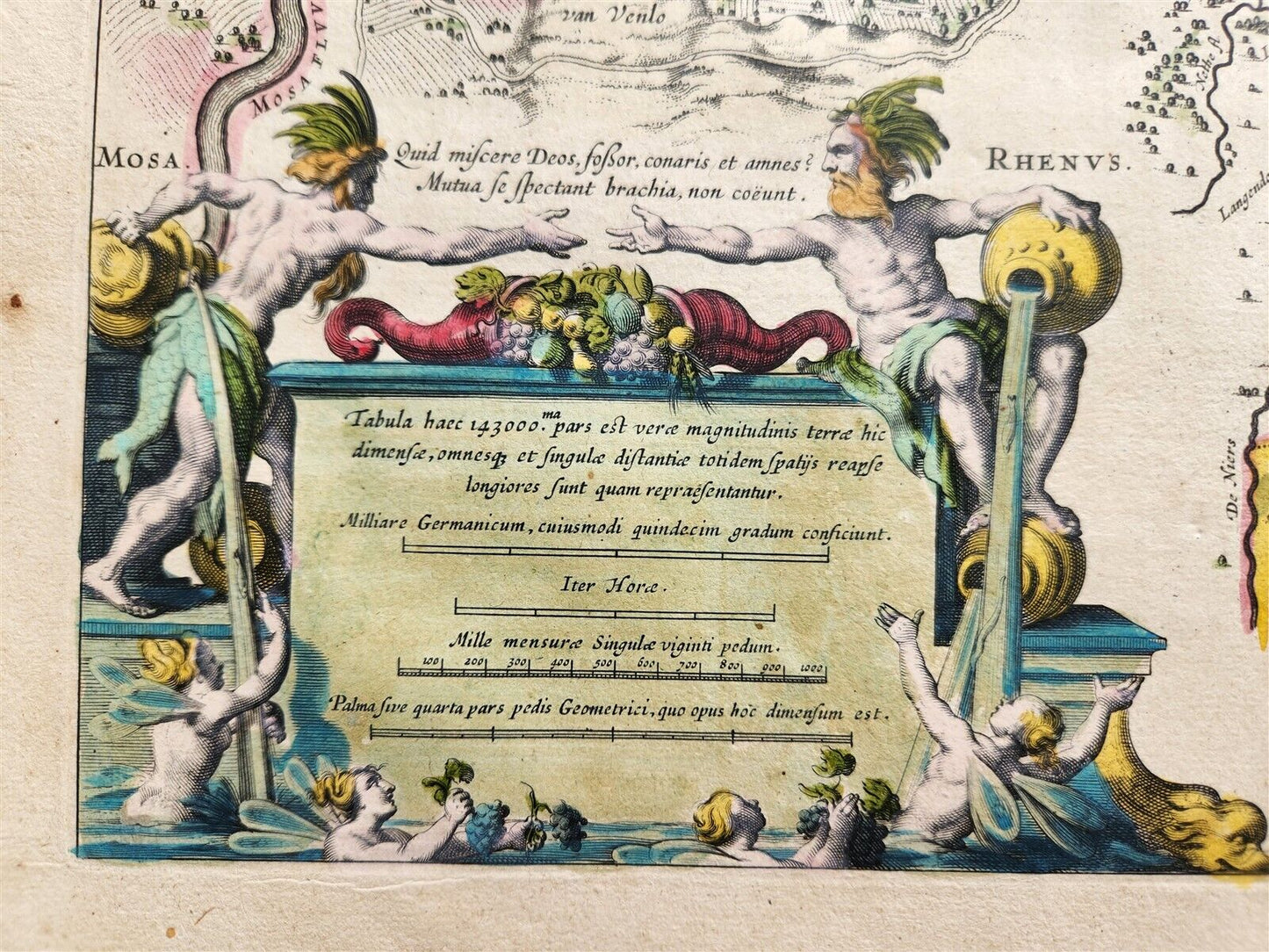
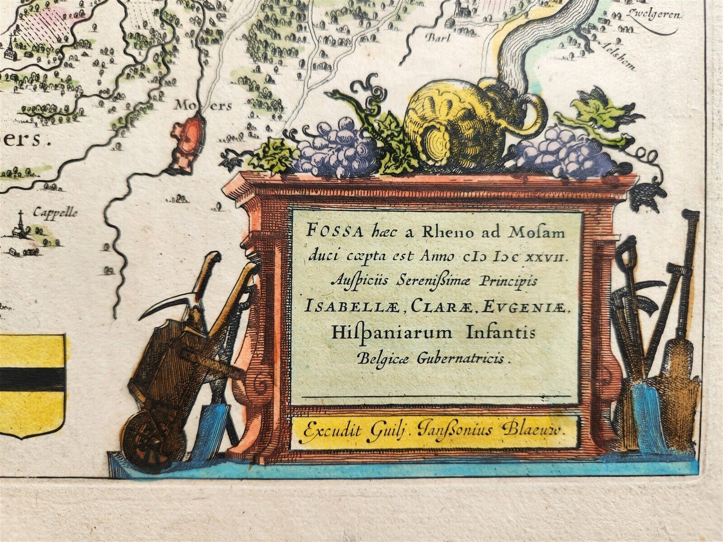
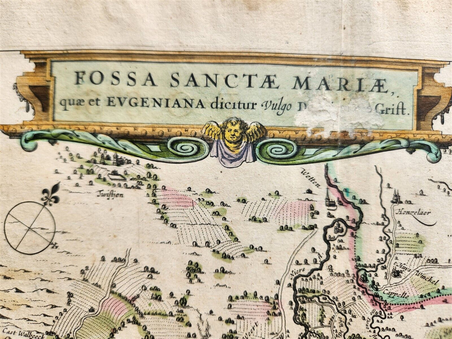
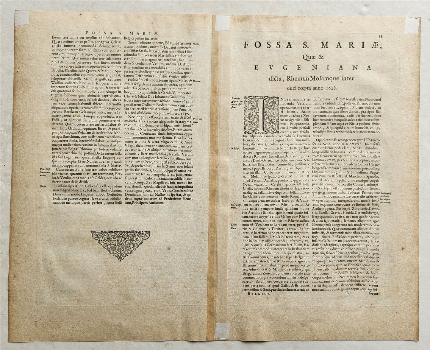
MAP FOSSA SANCTAE MARIAEAmsterdam: Willem Blaeu; 1640. (from : Theatrum orbis terrarum, sive Atlas novus)Map of Germany "Fossa Sanctae Mariae" also known as the Fossa Eugeniana, refers to a defensive canal, or "New Grift," planned between Rheinberg and Venlo in the Low Countries, with a stretch between Rheinberg and Geldern being completed. Plate size 14 3/4 by 19 1/2 inches (overall 18 1/2 by 22 1/2 inches)Hand coloredVery good condition except some damage to the upper part, visible in the scan100% authentic=========================================Please see my other auctions Thank You
Refund Policy: We will issue a FULL REFUND, 100% money back if you are not satisfied with your purchase. Items must be returned to us within 20 days in order to receive a refund or replacement. Buyer is responsible for shipping costs.
---------------------------------------------------------------------------------------------------------------------------------------------------------------------------------------------------------------------------------------------------------------------------------------------------------------------------------------------------------------------------------------------------------------------------------------------------------------------------------------------------------------------------------------------------------------------------------------------------------------------------------------------------------------------------------------------------------------------------------------------------------------------------------------------------------------------------------------------------------------------------
MAP FOSSA SANCTAE MARIAEAmsterdam: Willem Blaeu; 1640. (from : Theatrum orbis terrarum, sive Atlas novus)Map of Germany "Fossa Sanctae Mariae" also known as the Fossa Eugeniana, refers to a defensive canal, or "New Grift," planned between Rheinberg and Venlo in the Low Countries, with a stretch between Rheinberg and Geldern being completed. Plate size 14 3/4 by 19 1/2 inches (overall 18 1/2 by 22 1/2 inches)Hand coloredVery good condition except some damage to the upper part, visible in the scan100% authentic
--------------------------------------------------------------------------------------------------------------------------------------------------------------------------------------------------------------------------------------------------------------------------------------------------------------------------------------------------------------------------------------------------------------------------------------------------------------------------------------------------------------------------------------------
MAP
FOSSA SANCTAE MARIAE
Amsterdam: Willem Blaeu; 1640.
(from : Theatrum orbis terrarum, sive Atlas novus)
Map of Germany
"Fossa Sanctae Mariae"
also known as the Fossa Eugeniana, refers to a defensive canal, or "New Grift,"
planned between Rheinberg and Venlo in the Low Countries, with a stretch between Rheinberg and Geldern being completed.
Plate size 14 3/4 by 19 1/2 inches (overall 18 1/2 by 22 1/2 inches)
Hand colored
Very good condition except some damage to the upper part, visible in the scan
100% authentic
=========================================
Please see my other auctions
Thank You
Refund Policy: We will issue a FULL REFUND, 100% money back if you are not satisfied with your purchase. Items must be returned to us within 20 days in order to receive a refund or replacement. Buyer is responsible for shipping costs.
Powered by SixBit's eCommerce Solution
View full details
- Country/Region:Germany
- Date Range:1600-1699
- Type:Topographical Map