Motka
1640 MAP of Hainaut Namur BELGIUM by WILLEM BLAEU antique AUTHENTIC hand colored
1640 MAP of Hainaut Namur BELGIUM by WILLEM BLAEU antique AUTHENTIC hand colored
Regular price
$200.90 USD
Regular price
$287.00 USD
Sale price
$200.90 USD
Unit price
per
Couldn't load pickup availability
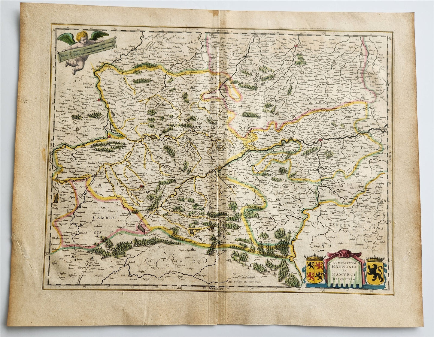
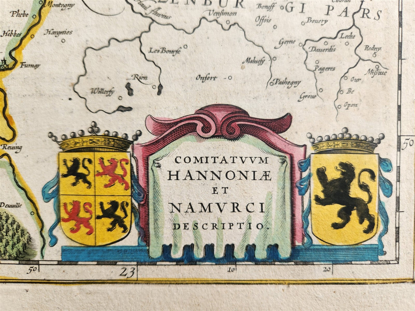
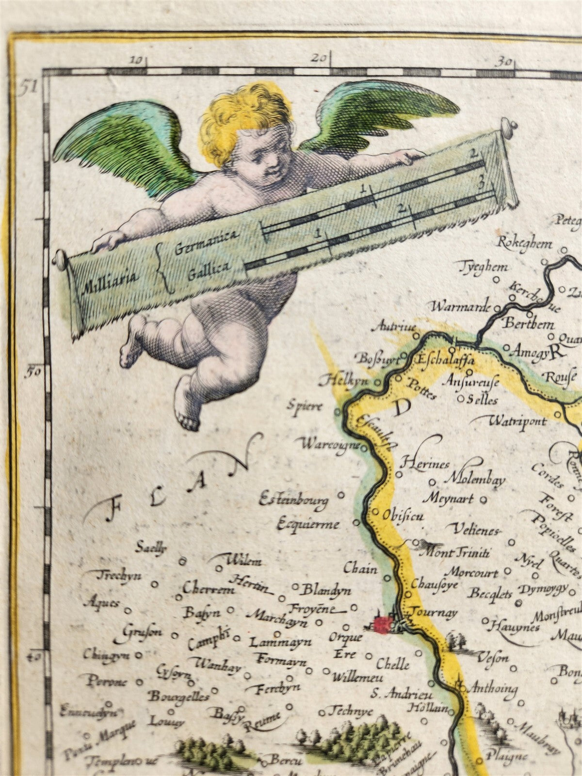
MAP COMITATUUM HANNONIAE et NAMURCI DESCRIPTIOBELGIUMAmsterdam: Willem Blaeu; 1640. (from : Theatrum orbis terrarum, sive Atlas novus)"Comitatuum Hannoniae et Namurci Descriptio" translates to "Description of the Counties of Hainaut and Namur" in English. This title refers to a map or description, specifically, a cartographical representation of the Counties of Hainaut and Namur, which are historical regions in modern-day Belgium. These regions were part of the Spanish Netherlands or later the Austrian Netherlands before the formation of Belgium.Hand coloredOverall 17 3/4 by 22 1/2 inchesVery good condition100% authentic=========================================Please see my other auctions Thank You
Refund Policy: We will issue a FULL REFUND, 100% money back if you are not satisfied with your purchase. Items must be returned to us within 20 days in order to receive a refund or replacement. Buyer is responsible for shipping costs.
------------------------------------------------------------------------------------------------------------------------------------------------------------------------------------------------------------------------------------------------------------------------------------------------------------------------------------------------------------------------------------------------------------------------------------------------------------------------------------------------------------------------------------------------------------------------------------------------------------------------------------------------------------------------------------------------------------------------------------------------------------------------------------------------------------------------------------------------------------------------------------------------------------------------------------------------------------------------------------------------------------
MAP COMITATUUM HANNONIAE et NAMURCI DESCRIPTIOBELGIUMAmsterdam: Willem Blaeu; 1640. (from : Theatrum orbis terrarum, sive Atlas novus)"Comitatuum Hannoniae et Namurci Descriptio" translates to "Description of the Counties of Hainaut and Namur" in English. This title refers to a map or description, specifically, a cartographical representation of the Counties of Hainaut and Namur, which are historical regions in modern-day Belgium. These regions were part of the Spanish Netherlands or later the Austrian Netherlands before the formation of Belgium.Hand coloredOverall 17 3/4 by 22 1/2 inchesVery good condition100% authentic
-----------------------------------------------------------------------------------------------------------------------------------------------------------------------------------------------------------------------------------------------------------------------------------------------------------------------------------------------------------------------------------------------------------------------------------------------------------------------------------------------------------------------------------------------------------------------------------------------------------------------------------------------------------------------------
MAP
COMITATUUM HANNONIAE et NAMURCI DESCRIPTIO
BELGIUM
Amsterdam: Willem Blaeu; 1640.
(from : Theatrum orbis terrarum, sive Atlas novus)
"Comitatuum Hannoniae et Namurci Descriptio" translates to "Description of the Counties of Hainaut and Namur" in English.
This title refers to a map or description, specifically, a cartographical representation of the Counties of Hainaut and Namur, which are historical regions in modern-day Belgium.
These regions were part of the Spanish Netherlands or later the Austrian Netherlands before the formation of Belgium.
Hand colored
Overall 17 3/4 by 22 1/2 inches
Very good condition
100% authentic
=========================================
Please see my other auctions
Thank You
Refund Policy: We will issue a FULL REFUND, 100% money back if you are not satisfied with your purchase. Items must be returned to us within 20 days in order to receive a refund or replacement. Buyer is responsible for shipping costs.
Powered by SixBit's eCommerce Solution
View full details
- Country/Region:Belgium
- Date Range:1600-1699
- Original/Reproduction:Antique Original
- Type:Topographical Map
- Year:1640