Motka
1640 MAP of HOLLANDIA NETHERLANDS by WILLEM BLAEU antique AUTHENTIC
1640 MAP of HOLLANDIA NETHERLANDS by WILLEM BLAEU antique AUTHENTIC
Regular price
$200.90 USD
Regular price
$287.00 USD
Sale price
$200.90 USD
Unit price
per
Couldn't load pickup availability
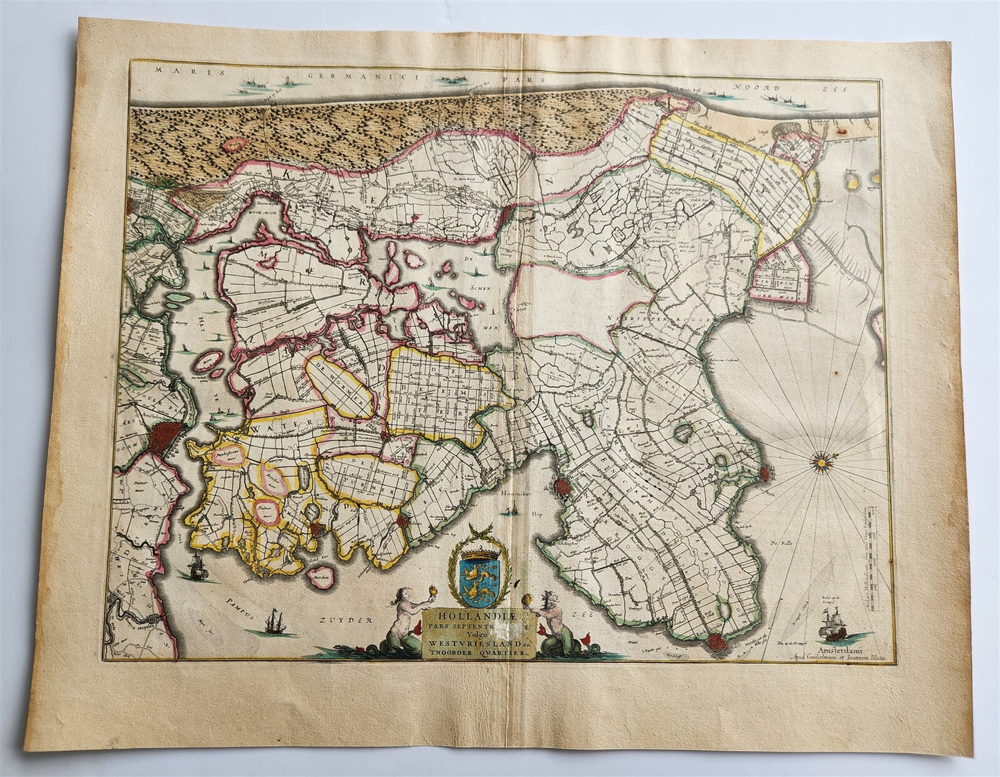
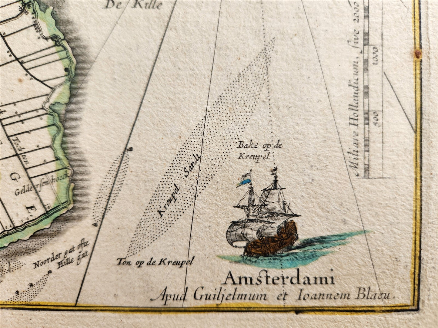
MAP Hollandiae pars septentrionalis, Vulgo Westuriesland en Tnoorder QuartierNETHERLANDSAmsterdam: Willem Blaeu; 1640. (from : Theatrum orbis terrarum, sive Atlas novus)Northern Holland with Amsterdam and the neighboring area. Hand coloredOverall 18.5 by 22.5 inchesVery good condition, small damage to the lower part, visible on the scan100% authentic=========================================Please see my other auctions Thank You
Refund Policy: We will issue a FULL REFUND, 100% money back if you are not satisfied with your purchase. Items must be returned to us within 20 days in order to receive a refund or replacement. Buyer is responsible for shipping costs.
--------------------------------------------------------------------------------------------------------------------------------------------------------------------------------------------------------------------------------------------------------------------------------------------------------------------------------------------------------------------------------------------------------------------------------------------------------------------------------------------------------------------------------------------------------------------------------------------------------------------------------------------------------------------------------------------------------------
MAP Hollandiae pars septentrionalis, Vulgo Westuriesland en Tnoorder QuartierNETHERLANDSAmsterdam: Willem Blaeu; 1640. (from : Theatrum orbis terrarum, sive Atlas novus)Northern Holland with Amsterdam and the neighboring area. Hand coloredOverall 18.5 by 22.5 inchesVery good condition, small damage to the lower part, visible on the scan100% authentic
-------------------------------------------------------------------------------------------------------------------------------------------------------------------------------------------------------------------------------------------------------------------------------------------------------------------------------------------------------------------------------
MAP
Hollandiae pars septentrionalis, Vulgo Westuriesland en Tnoorder Quartier
NETHERLANDS
Amsterdam: Willem Blaeu; 1640.
(from : Theatrum orbis terrarum, sive Atlas novus)
Northern Holland with Amsterdam and the neighboring area.
Hand colored
Overall 18.5 by 22.5 inches
Very good condition, small damage to the lower part, visible on the scan
100% authentic
=========================================
Please see my other auctions
Thank You
Refund Policy: We will issue a FULL REFUND, 100% money back if you are not satisfied with your purchase. Items must be returned to us within 20 days in order to receive a refund or replacement. Buyer is responsible for shipping costs.
Powered by SixBit's eCommerce Solution
View full details
- Country/Region:Netherlands
- Date Range:1600-1699
- Original/Reproduction:Antique Original
- Type:Topographical Map
- Year:1640