Motka
1640 MAP of Overijssel NETHERLANDS by WILLEM BLAEU antique AUTHENTIC handcolored
1640 MAP of Overijssel NETHERLANDS by WILLEM BLAEU antique AUTHENTIC handcolored
Regular price
$200.90 USD
Regular price
$287.00 USD
Sale price
$200.90 USD
Unit price
per
Couldn't load pickup availability
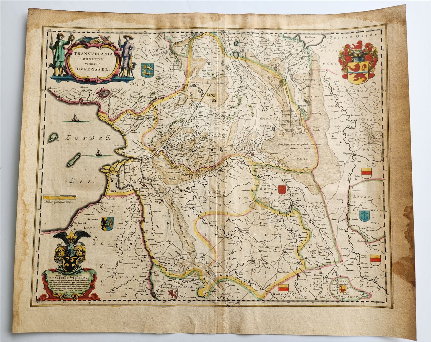
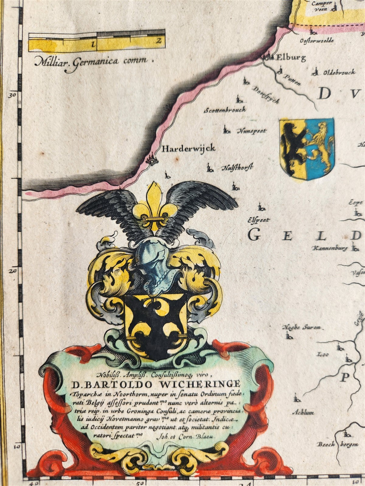
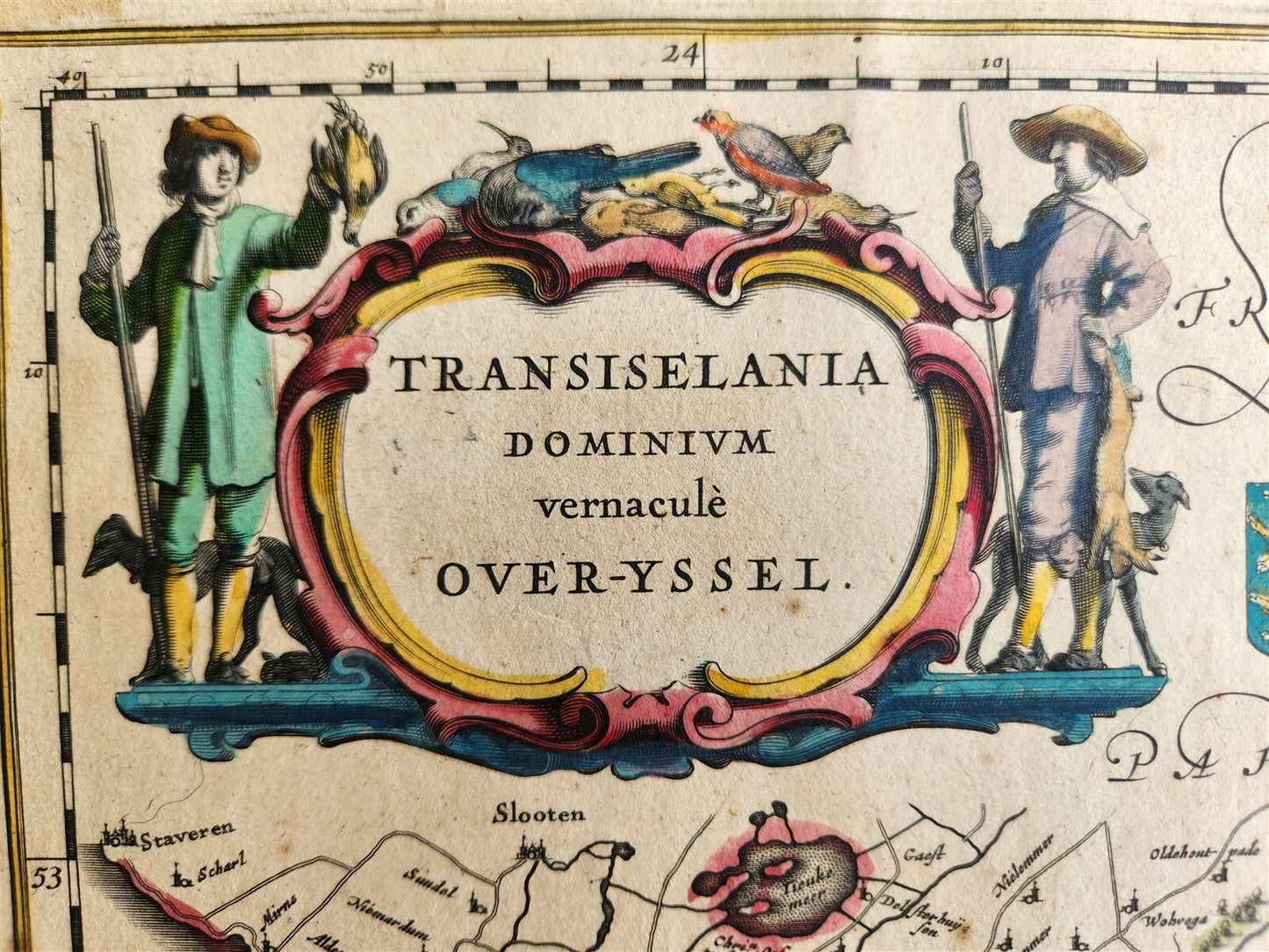
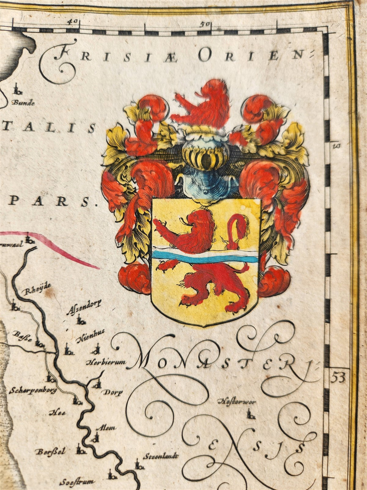
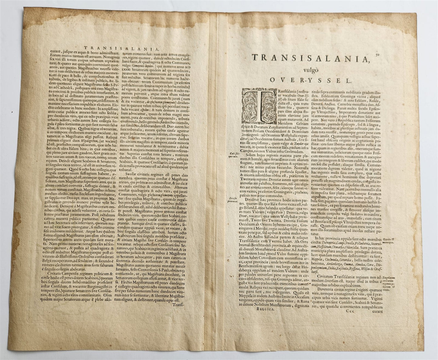
MAP TRANSISELANIA DOMINIUM VERNACULE OVER-YSSELAmsterdam: Willem Blaeu; 1640. (from : Theatrum orbis terrarum, sive Atlas novus)"Transiselania Dominum vernacule Over-Yssel" refers to the province of Overijssel in the Netherlands. "Transiselania" is Latin for "across the Yssel," referring to the province's location on the western side of the Yssel Lake. "Over-Yssel" is the Dutch equivalent. The term was used in antique maps and publications, particularly in Joan Blaeu's Atlas Novus, to designate the area encompassing the province of Overijssel and parts of Drenthe. Hand coloredOverall 18 3/4 by 22 3.4 inchesVery good condition, some spots to the margins100% authentic=========================================Please see my other auctions Thank You
Refund Policy: We will issue a FULL REFUND, 100% money back if you are not satisfied with your purchase. Items must be returned to us within 20 days in order to receive a refund or replacement. Buyer is responsible for shipping costs.
----------------------------------------------------------------------------------------------------------------------------------------------------------------------------------------------------------------------------------------------------------------------------------------------------------------------------------------------------------------------------------------------------------------------------------------------------------------------------------------------------------------------------------------------------------------------------------------------------------------------------------------------------------------------------------------------------------------------------------------------------------------------------------------------------------------------------------------------------------------------------------------------------------------------------------------------------------------------------------------------------------------------------------------------------------
MAP TRANSISELANIA DOMINIUM VERNACULE OVER-YSSELAmsterdam: Willem Blaeu; 1640. (from : Theatrum orbis terrarum, sive Atlas novus)"Transiselania Dominum vernacule Over-Yssel" refers to the province of Overijssel in the Netherlands. "Transiselania" is Latin for "across the Yssel," referring to the province's location on the western side of the Yssel Lake. "Over-Yssel" is the Dutch equivalent. The term was used in antique maps and publications, particularly in Joan Blaeu's Atlas Novus, to designate the area encompassing the province of Overijssel and parts of Drenthe. Hand coloredOverall 18 3/4 by 22 3.4 inchesVery good condition, some spots to the margins100% authentic
---------------------------------------------------------------------------------------------------------------------------------------------------------------------------------------------------------------------------------------------------------------------------------------------------------------------------------------------------------------------------------------------------------------------------------------------------------------------------------------------------------------------------------------------------------------------------------------------------------------------------------------------------------------------------------------------------------------------------
MAP
TRANSISELANIA DOMINIUM VERNACULE OVER-YSSEL
Amsterdam: Willem Blaeu; 1640.
(from : Theatrum orbis terrarum, sive Atlas novus)
"Transiselania Dominum vernacule Over-Yssel" refers to the province of Overijssel in the Netherlands.
"Transiselania" is Latin for "across the Yssel," referring to the province's location on the western side of the Yssel Lake.
"Over-Yssel" is the Dutch equivalent.
The term was used in antique maps and publications, particularly in Joan Blaeu's Atlas Novus, to designate the area encompassing the province of Overijssel and parts of Drenthe.
Hand colored
Overall 18 3/4 by 22 3.4 inches
Very good condition, some spots to the margins
100% authentic
=========================================
Please see my other auctions
Thank You
Refund Policy: We will issue a FULL REFUND, 100% money back if you are not satisfied with your purchase. Items must be returned to us within 20 days in order to receive a refund or replacement. Buyer is responsible for shipping costs.
Powered by SixBit's eCommerce Solution
View full details
- Country/Region:Netherlands
- Date Range:1600-1699
- Original/Reproduction:Antique Original
- Type:Topographical Map
- Year:1640