Motka
1705 FRANCE antique MAP Battle plan of Louis Le Grand Dauphin's campain
1705 FRANCE antique MAP Battle plan of Louis Le Grand Dauphin's campain
Regular price
$98.00 USD
Regular price
$140.00 USD
Sale price
$98.00 USD
Unit price
per
Couldn't load pickup availability
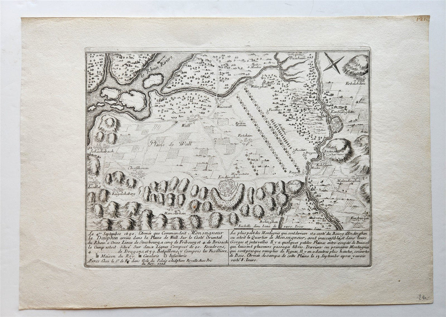
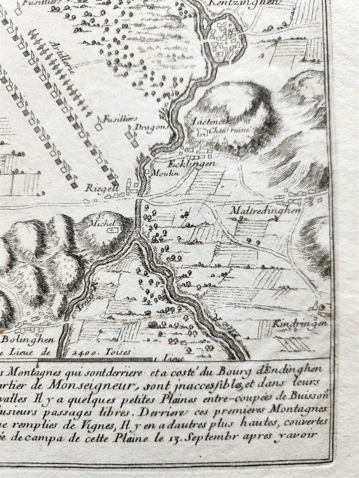
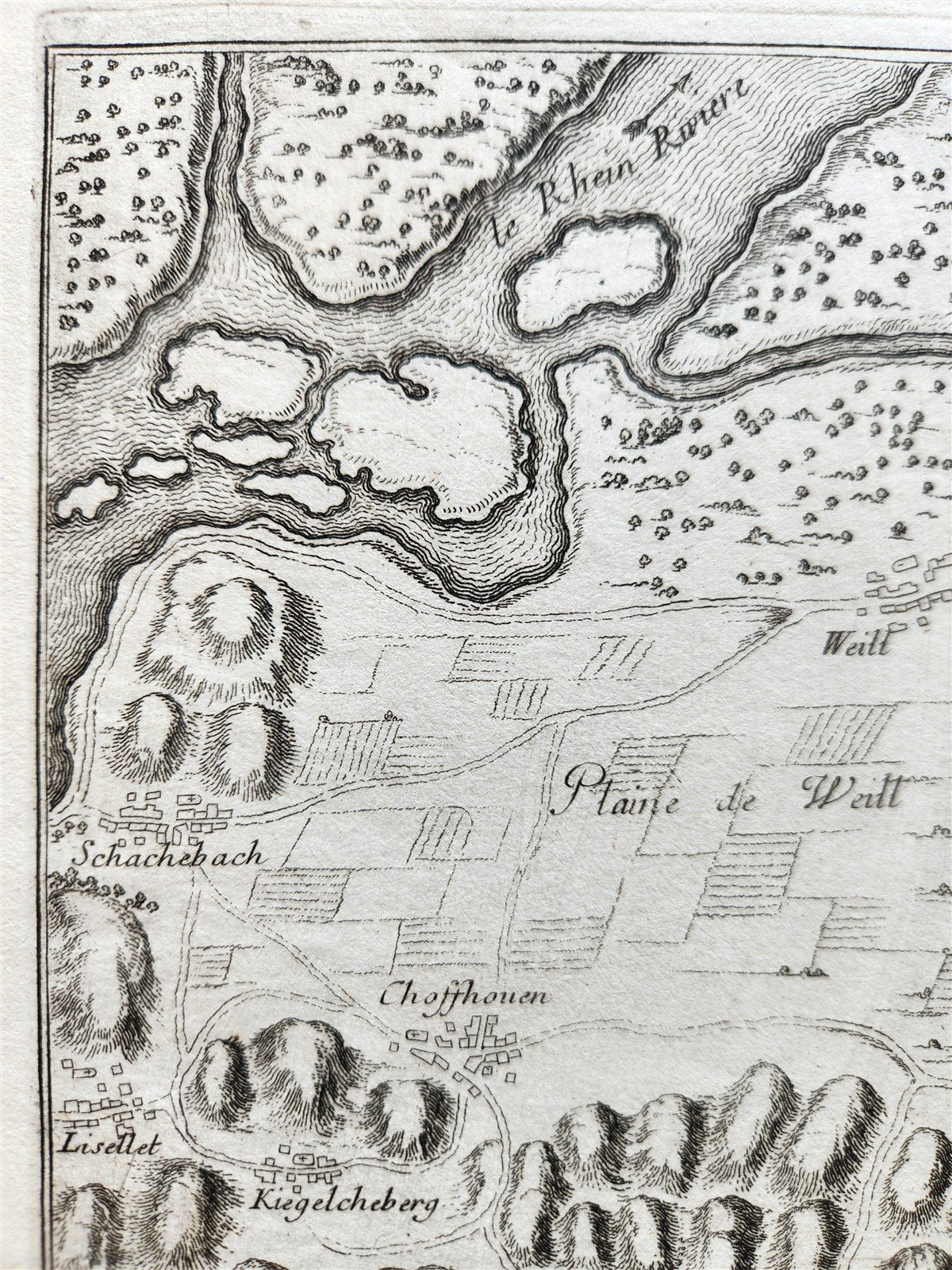
Le 4me. Septemre 1690.
L'Armee que Commandoit Monseigneur le DAuphin arriva la Plaine de Weill, sur le Cote Oriental du Rhein a Ouze Lieues de Strasboug, a ccinqe de Fribour, et 4m. de Brisach
Paris; c. 1705
(battle plan of the engagement near Endingen and the Plaine de Weill , from De Fer's Atlas Curieux.
The map shows Louis Le Grand Dauphin's campain across the Rhine River in 1690)
copper engraving on paper
Size 11 by 15 3/4 inches
Very good condition
===========================================================
Please see my other auctions
Thank You
Refund Policy: We will issue a FULL REFUND, 100% money back if you are not satisfied with your purchase. Items must be returned to us within 20 days in order to receive a refund or replacement. Buyer is responsible for shipping costs.