Motka
1720 UKRAINE antique MAP Ukrania Terra Cosaccorum Walachiae Moldoviae J. HOMANN
1720 UKRAINE antique MAP Ukrania Terra Cosaccorum Walachiae Moldoviae J. HOMANN
Regular price
$1,299.90 USD
Regular price
$1,857.00 USD
Sale price
$1,299.90 USD
Unit price
per
Couldn't load pickup availability
Johann Baptista Homann
Germany, ca. 1664–1724
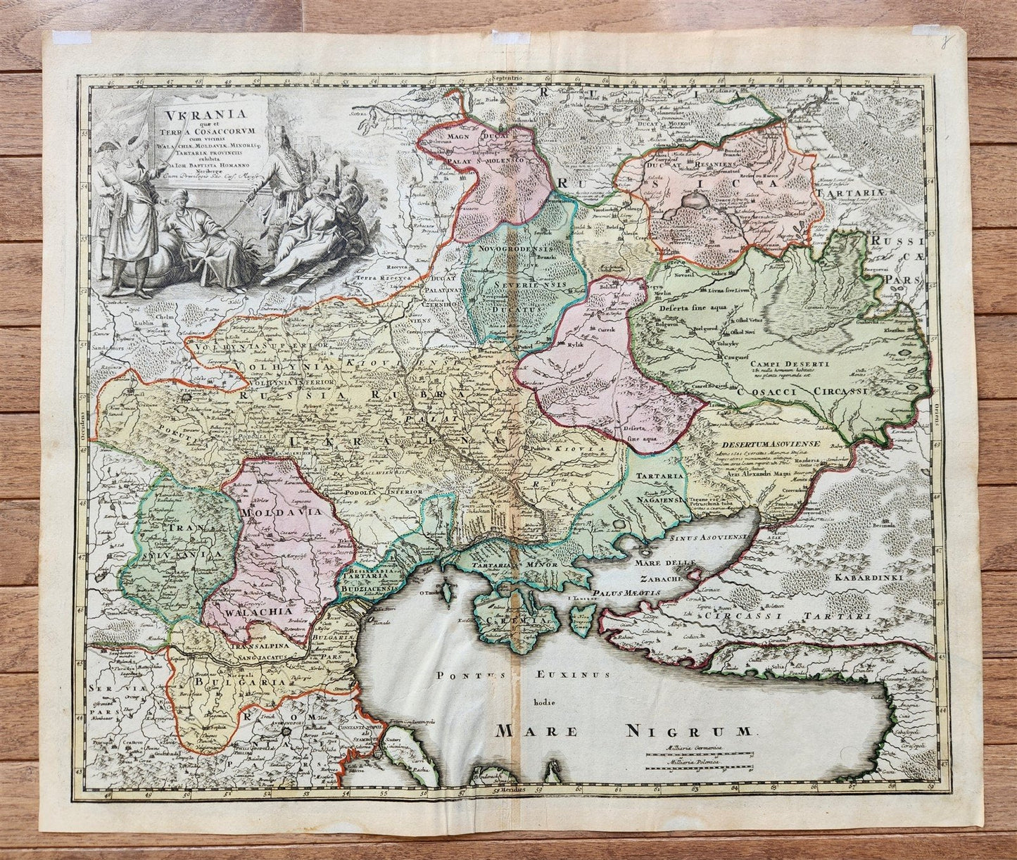
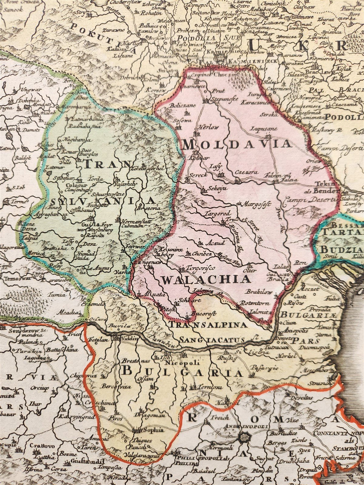
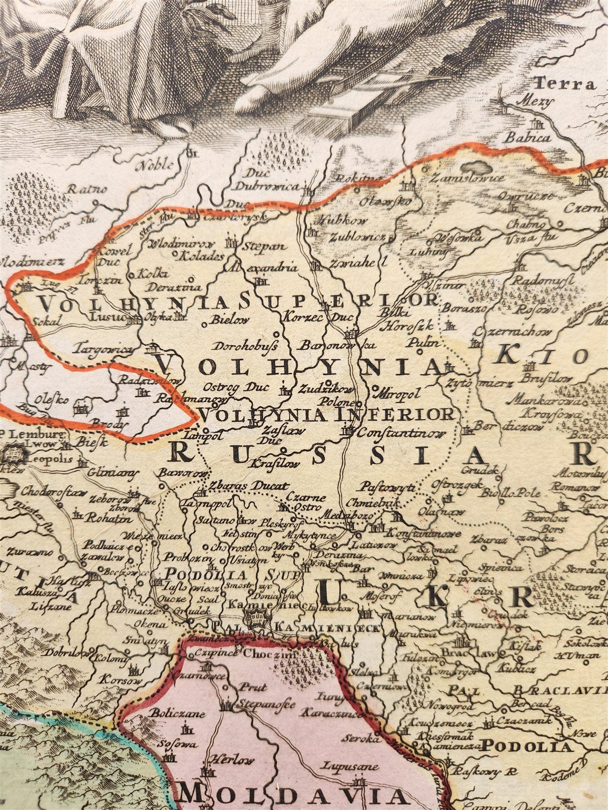
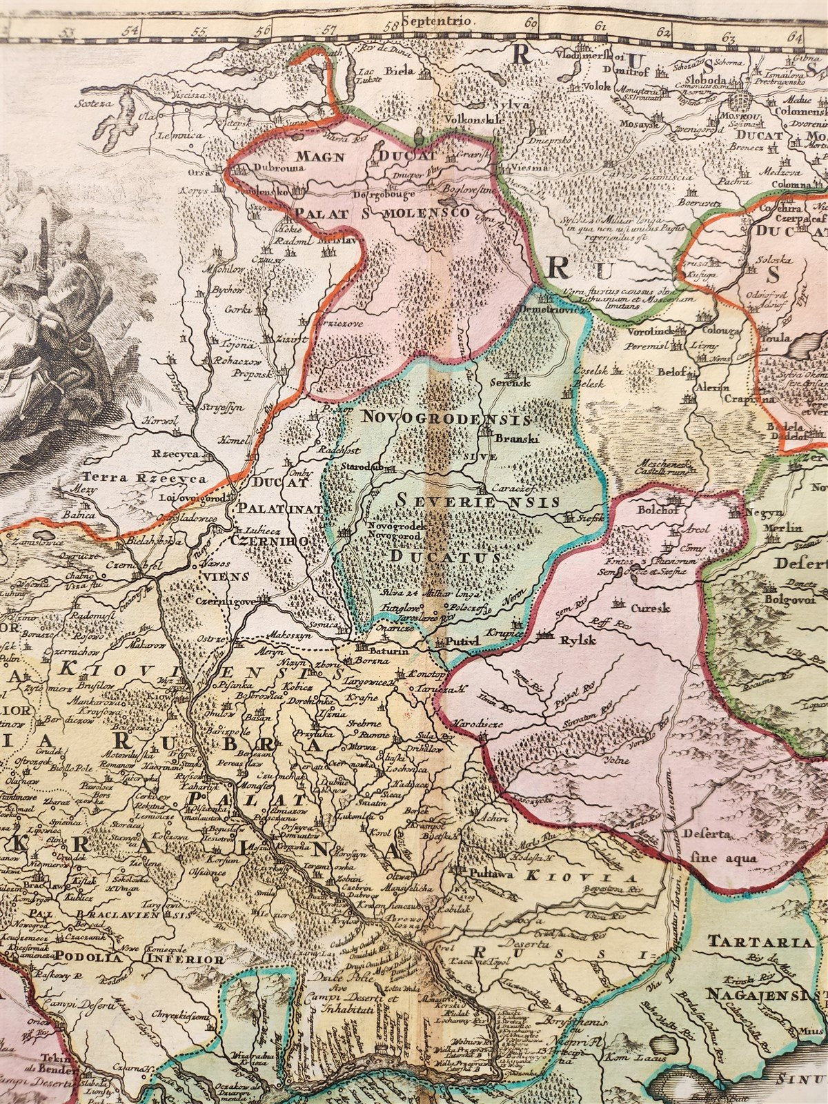
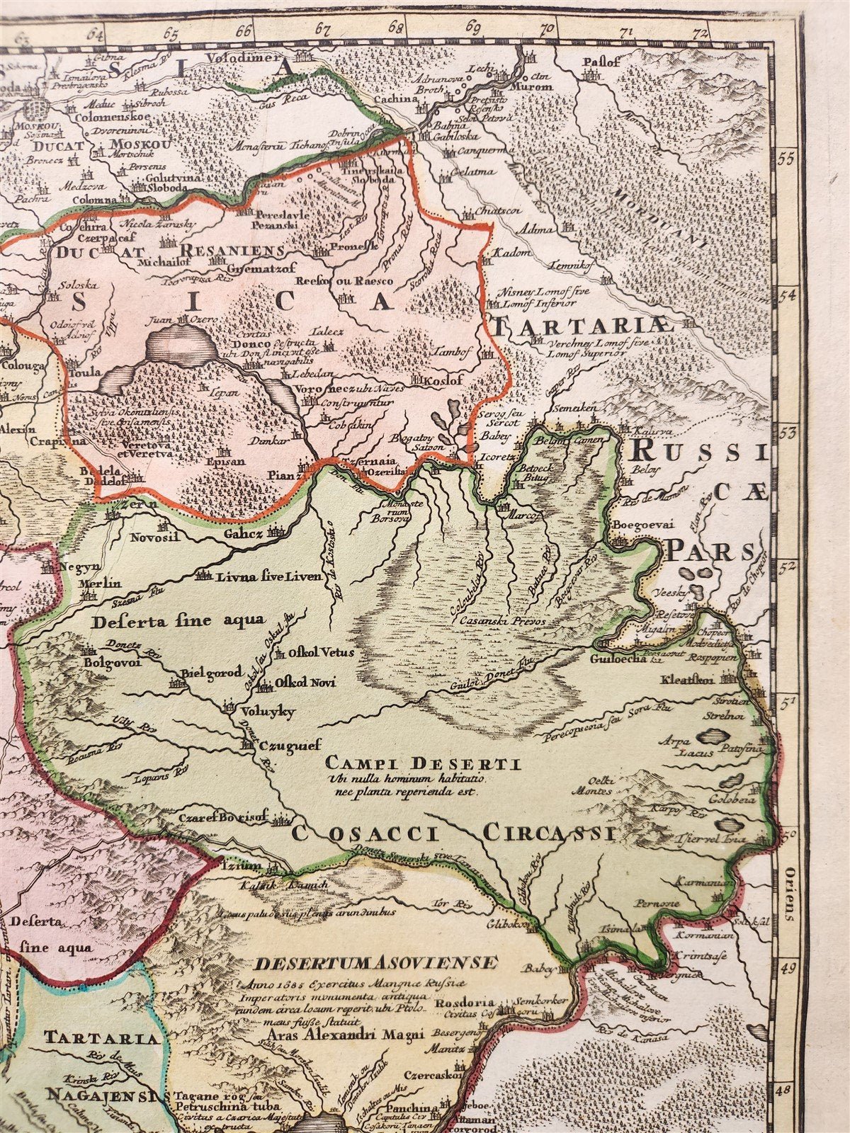
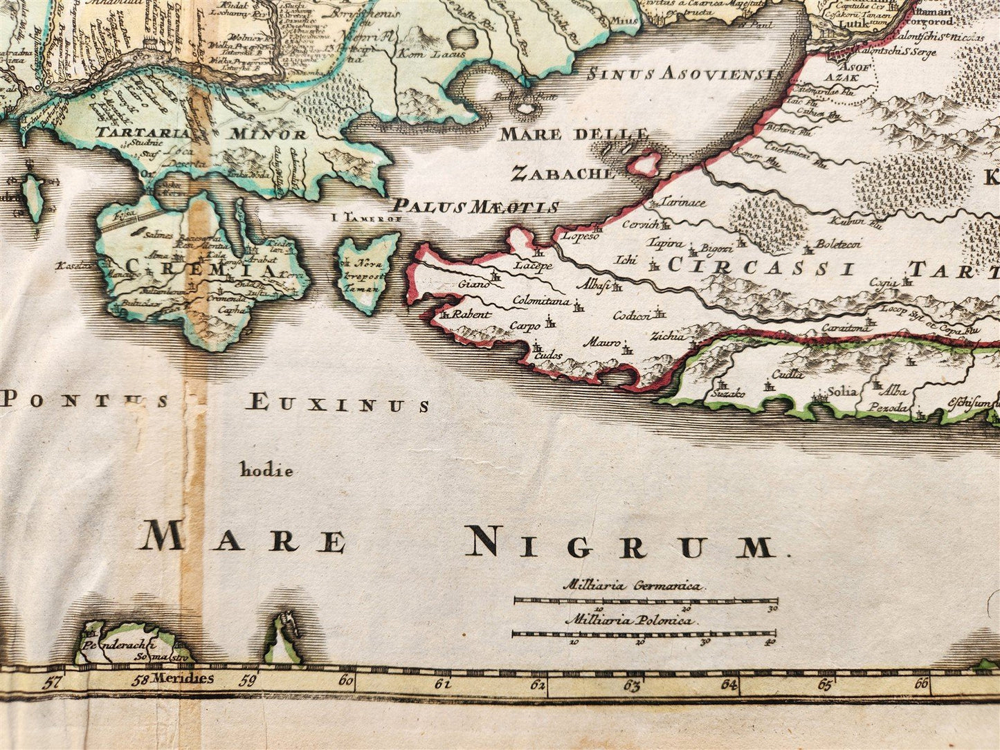
UKRAINE
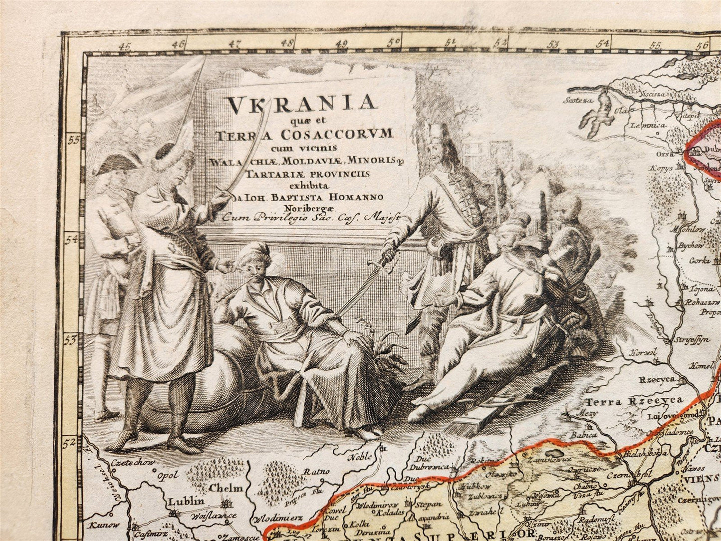
Ukrania quae et Terra Cosaccorum cum vicinis Walachiae, Moldoviae
Detailed map, extending from the the Ukraine, Russia, Moscovy and the Cossack Regions in the North, to the Black Sea, Circcasian Tartary, Constantiople and Transylvania in the South.
It is known by the abbreviated name "Terra Cosaccorum".
Johann Baptist Hohmann accumulated all the achievements of scientists, geographers, historians and data about the current situation in Ukraine known at the beginning of the 1700s to make this map.
The site of the Battle of Poltava in 1709 is marked on the map; the lands of Transdanubian Sich, which were transferred to Turkey in 1711, are marked as part of the Crimean Khanate; the specified construction of the Perekop Wall, etc.
In the cartouche, the territory is named Vkraina in the Latin manner, and already on the map itself it is marked as Ukraina.
Hand-colored etching on paper, undated (Nuremberg; c. 1720)
Size 21 by 24.5 inches
Good condition, repaired fold
===========================================================
The name Ukraine was popularized in the west by Guillaume La Vasseur de Beauplan's Description d'Ukraine, first published in Rouen in 1651.
The work described Ukraine as several provinces of the Kingdom of Poland lying between the borders of Muscovy and the frontiers of Transylvania.
Beauplan, a military engineer, had spent a significant period of time constructing fortresses in the region in the 1630s. In 1650, his map entitled Delineatio Specialis et Accurata Ukrainae, showed the palatinates of Kyiv, Bratslav, Podilia, Volhynia and part of Rus (Pokutia). Another of Beauplan's maps, published in 1648, entitled Delineatio Generalis Camporum Desortum vulgo Ukraina, Cum adjacentibus Provinciis, shows all of the provinces of Poland bordering on the Campus Desertorum or steppe frontier, thereby recognizing the Russian and Polish language references to Ukraine as the "steppe frontier" and leading to the popularization of the name in Western Europe.
The region was later defined by the Zboriv Treaty of 1649, which did not include Rus or Volhnia, but did include Chernihiv. This treaty established the Cossack control of the regions and severed Poland's claims and created the region which would come to be known in the west as the Ukraine.
Johann Baptist Homann (20 March 1664 – 1 July 1724) was a German geographer and cartographer, who also made maps of the Americas.
Homann was born in Oberkammlach near Kammlach in the Electorate of Bavaria. Although educated at a Jesuit school, and preparing for an ecclesiastical career, he eventually converted to Protestantism and from 1687 worked as a civil law notary in Nuremberg. He soon turned to engraving and cartography; in 1702 he founded his own publishing house.
Homann acquired renown as a leading German cartographer, and in 1715 was appointed Imperial Geographer by Holy Roman Emperor Charles VI. Giving such privileges to individuals was an added right that the Holy Roman Emperor enjoyed. In the same year he was also named a member of the Prussian Academy of Sciences in Berlin. Of particular significance to cartography were the imperial printing privileges (Latin: privilegia impressoria). These protected for a time the authors in all scientific fields such as printers, copper engravers, map makers and publishers. They were also very important as a recommendation for potential customers.
In 1716 Homann published his masterpiece Grosser Atlas ueber die ganze Welt (Grand Atlas of all the World). Numerous maps were drawn up in cooperation with the engraver Christoph Weigel the Elder, who also published Siebmachers Wappenbuch.
Homann died in Nuremberg in 1724. He was succeeded by his son Johann Christoph (1703–1730). The company carried on upon his death as Homann heirs company, managed by Johann Michael Franz and Johann Georg Ebersberger. After subsequent changes in management the company folded in 1852.[1] The company was known as "Homann Erben", "Homanniani Heredes", or "Heritiers de Homann" abroad.
=====================================================================================
Please see my other auctions
Thank You
Refund Policy: We will issue a FULL REFUND, 100% money back if you are not satisfied with your purchase. Items must be returned to us within 20 days in order to receive a refund or replacement. Buyer is responsible for shipping costs.
Country/Region: Ukraine
Date Range: 1700-1799
Original/Reproduction: Antique Original
Format: Atlas Map
Condition: Used Excellent