Motka
1716 CELESTIAL MAP antique SYSTEMA SOLARIUM et PLANETARIUM by Homann RARE
1716 CELESTIAL MAP antique SYSTEMA SOLARIUM et PLANETARIUM by Homann RARE
Regular price
$999.60 USD
Regular price
$1,428.00 USD
Sale price
$999.60 USD
Unit price
per
Couldn't load pickup availability
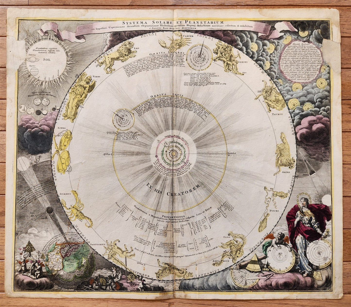
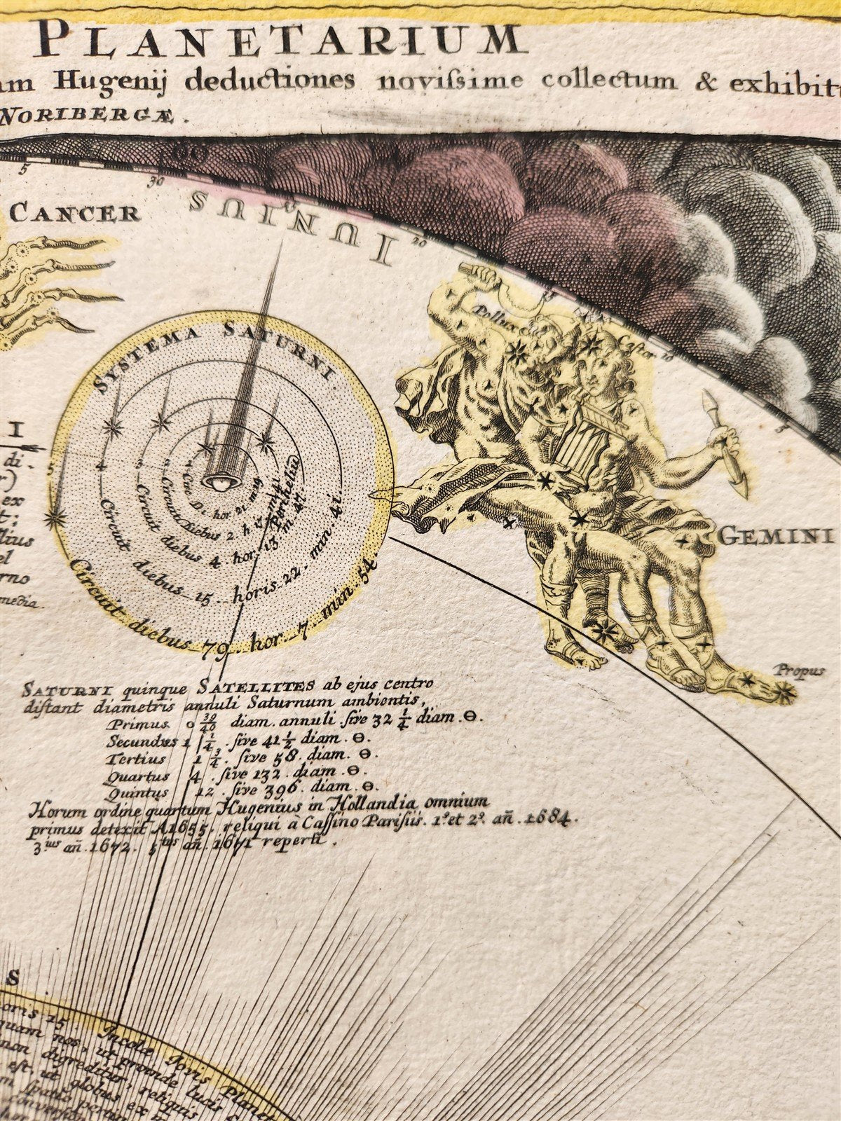
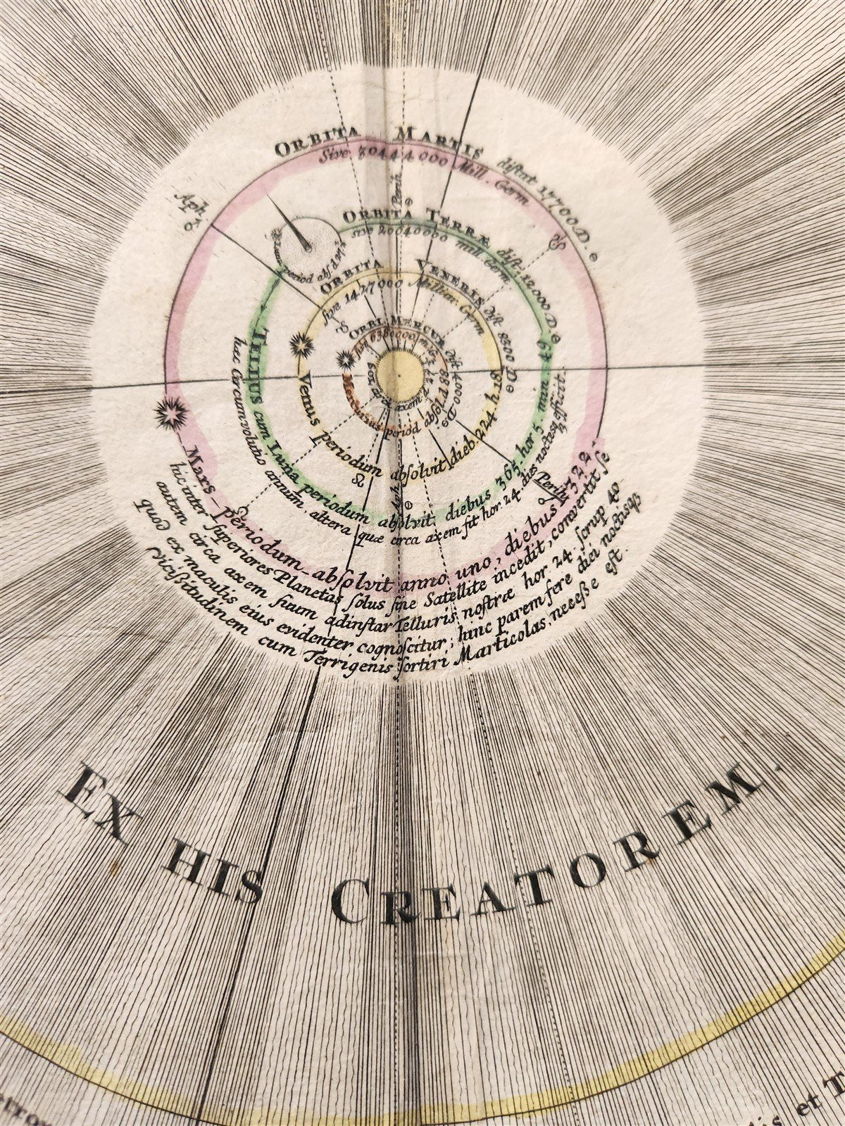
SYSTEMA SOLARIUM et PLANETARIUM
ex hypothesi Copernicana secundium elegantissimas Illustisimi quondam Hugenij deductiones novissime collectum & exhibitum . . .
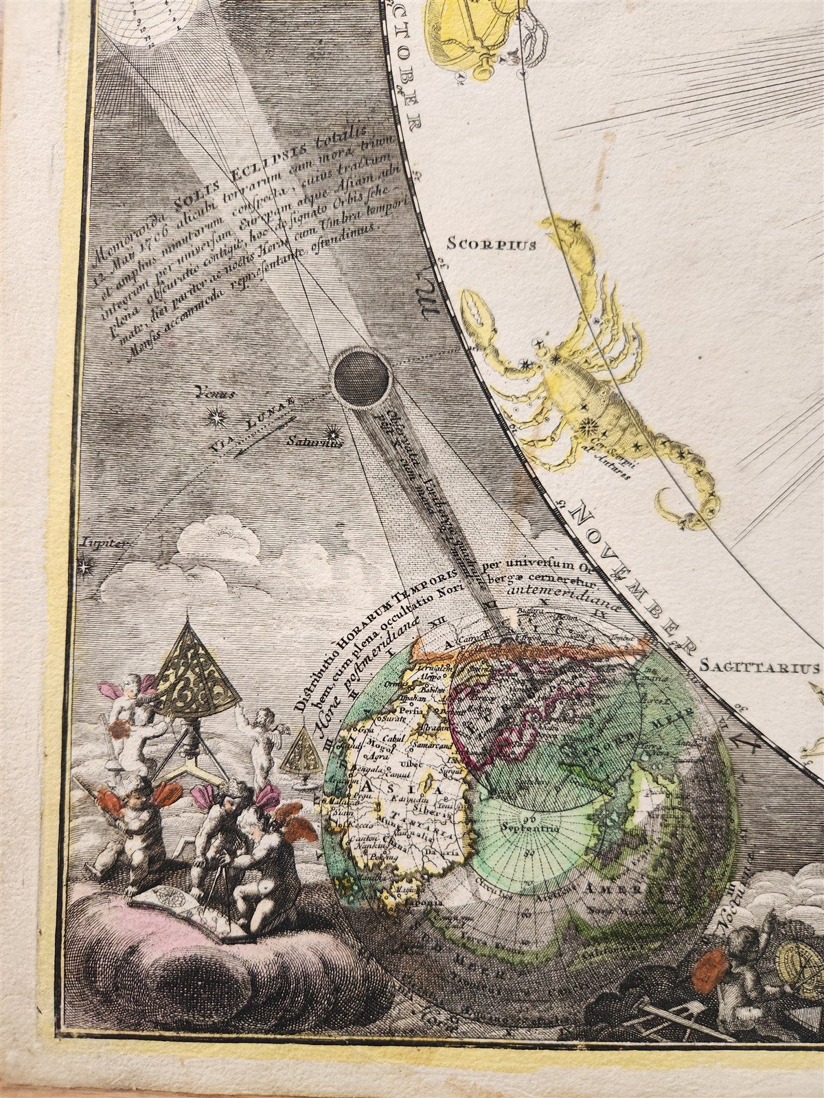
Solar system and constellations in the zodiac in the context of the solar eclipse of May 12, 1706
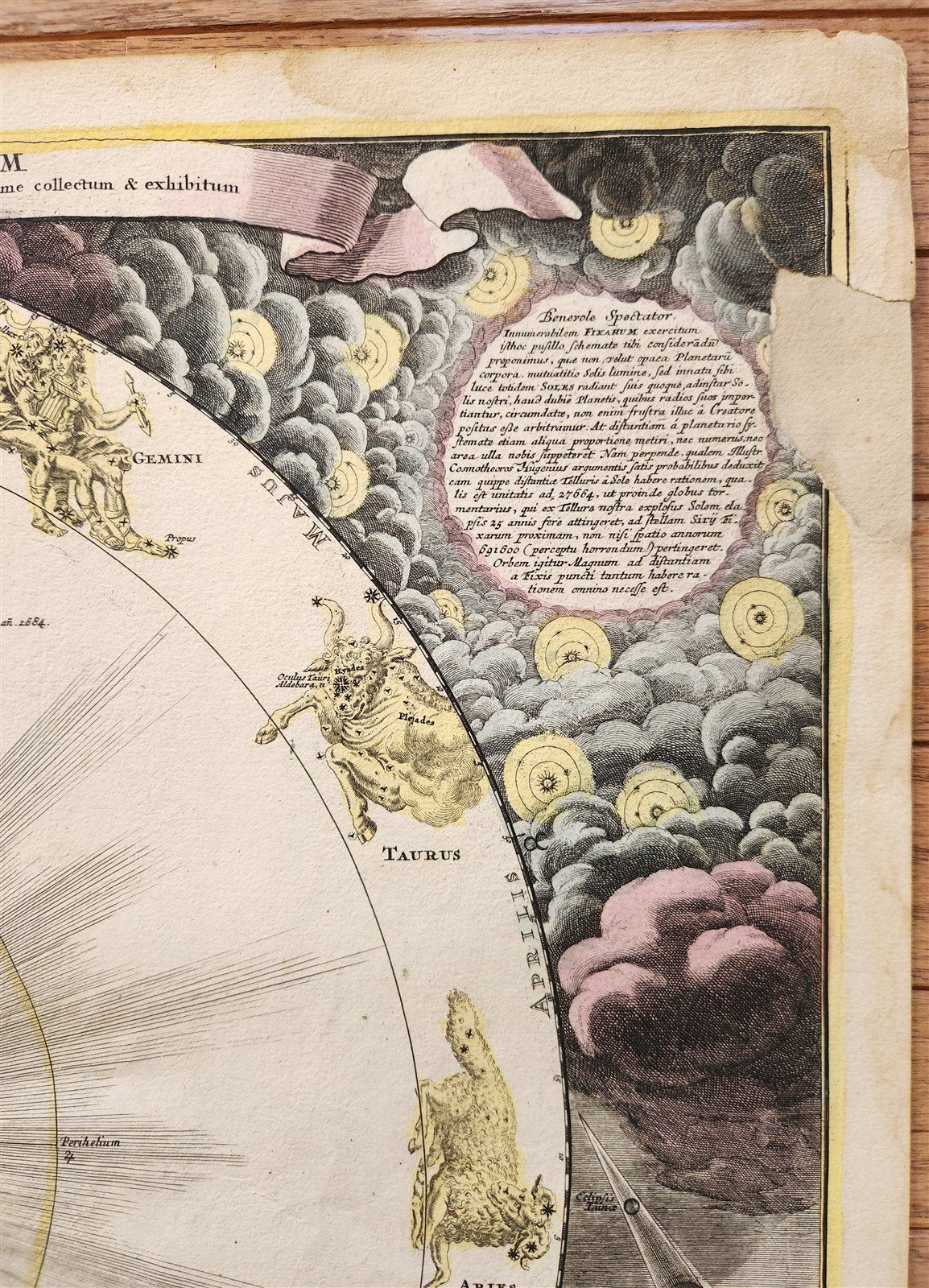
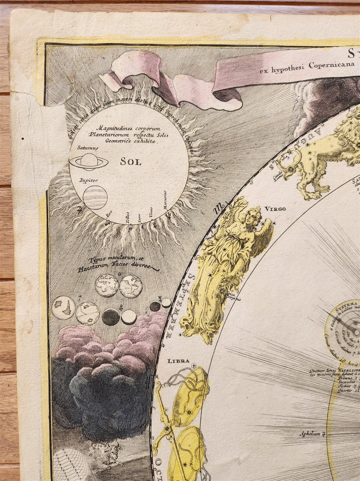
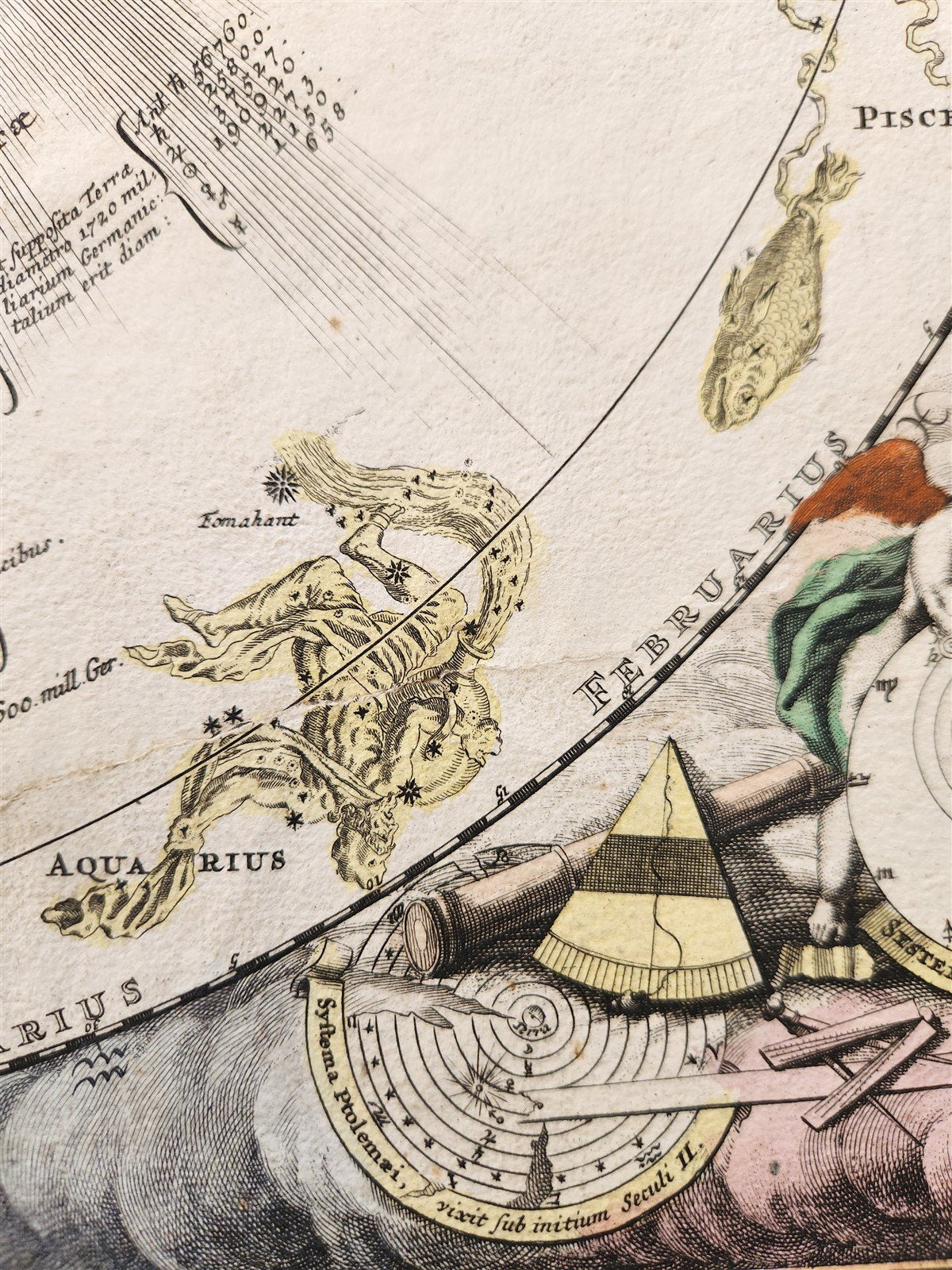
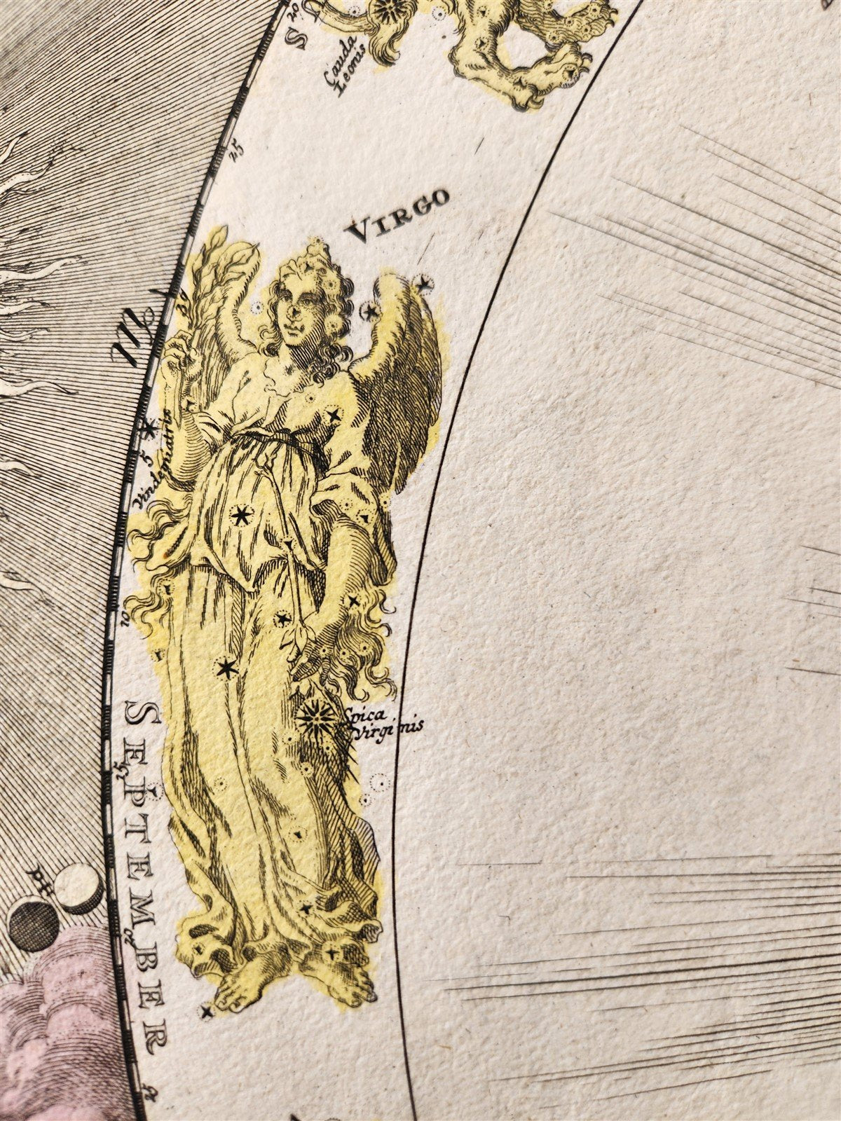
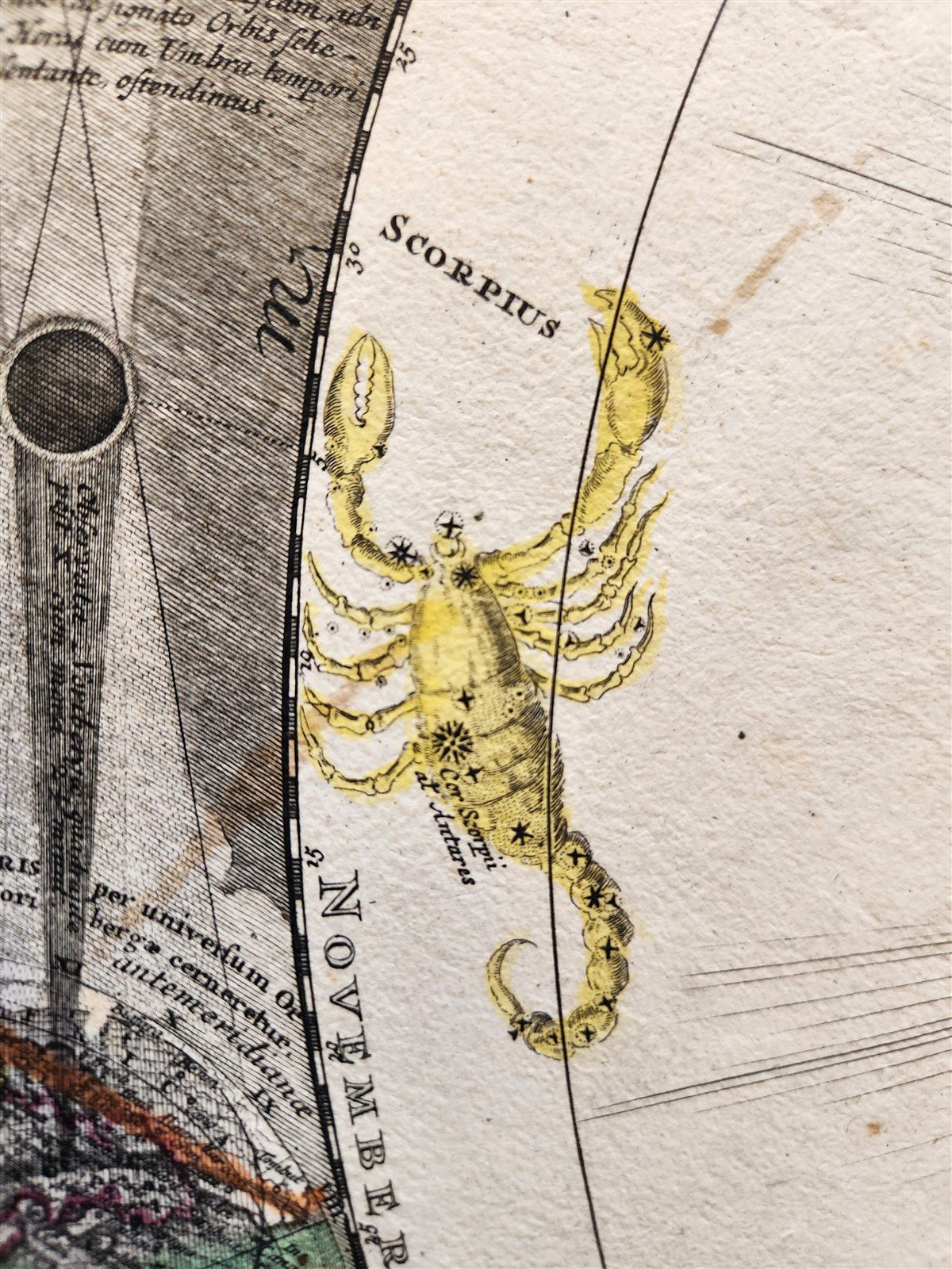
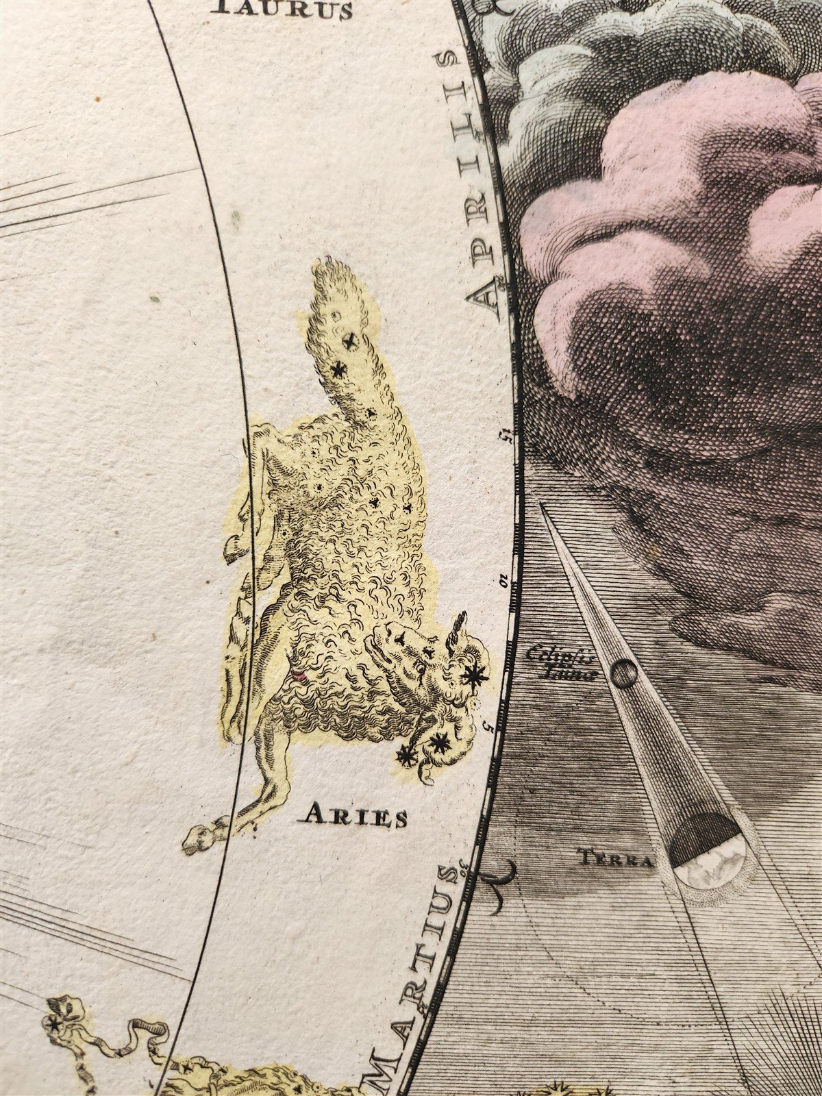
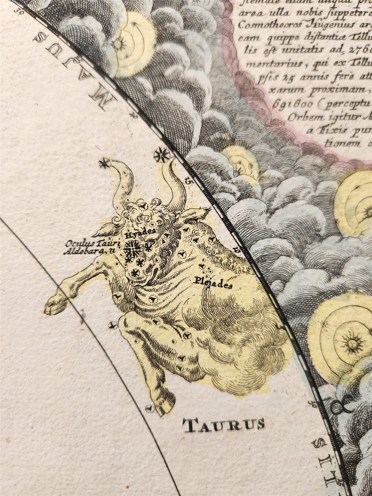
In the center, planetary paths from Earth and inner planets to Jupiter and Saturn are shown in a sunburst, all within a concentric ring of Baroque representations of the 12 signs of the zodiac.
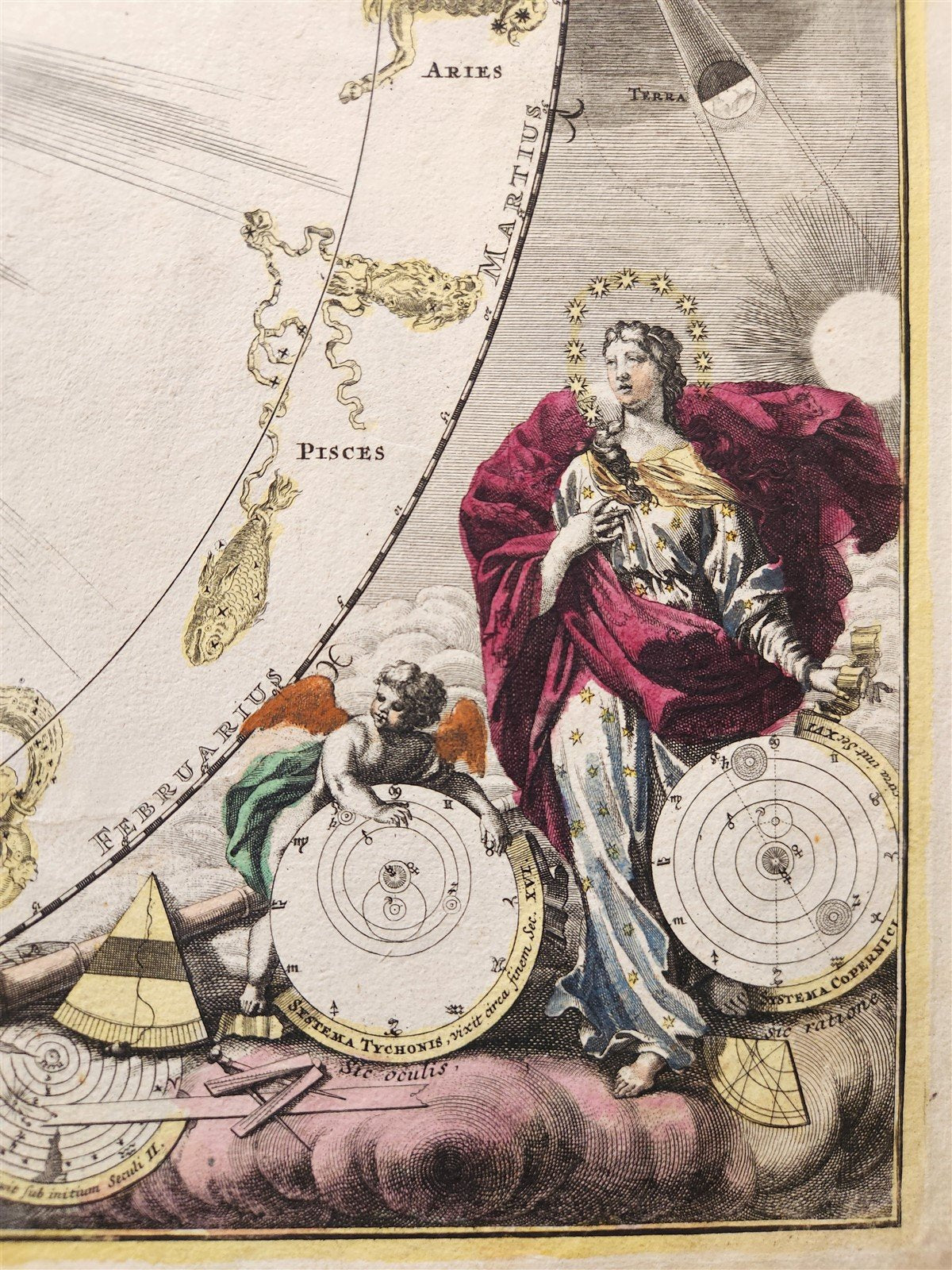
The trajectory of the planets, a schematic diagram of the eclipse formation, the sun, Urania (the Goddess of Astonomy) and the star gazing diagram of the eclipse formation, the sun, decorative images in the four corners of the chart.
This chart almost rivals those of Cellarius in its artistic arrangement of technical information complemented by elaborate surrounding illustrations. Here, however, Dopplemayr includes additonal astronomical information along with purely decorative touches. Urania, personified in the lower right corner is especially fetching as she daintily dangles a diagram of the Copernicus system from its decorative ribbon-like border.
Nuremberg: Johann Baptist Homann; c. 1716
Hand-colored copper engraving on paper
Size 20.5 by 23.5 inches
Good condition, fold in the middle. Repaired margins
===========================================================
Johann Baptist Homann (20 March 1664 – 1 July 1724) was a German geographer and cartographer, who also made maps of the Americas.
Homann was born in Oberkammlach near Kammlach in the Electorate of Bavaria. Although educated at a Jesuit school, and preparing for an ecclesiastical career, he eventually converted to Protestantism and from 1687 worked as a civil law notary in Nuremberg. He soon turned to engraving and cartography; in 1702 he founded his own publishing house.
Homann acquired renown as a leading German cartographer, and in 1715 was appointed Imperial Geographer by Holy Roman Emperor Charles VI. Giving such privileges to individuals was an added right that the Holy Roman Emperor enjoyed. In the same year he was also named a member of the Prussian Academy of Sciences in Berlin. Of particular significance to cartography were the imperial printing privileges (Latin: privilegia impressoria). These protected for a time the authors in all scientific fields such as printers, copper engravers, map makers and publishers. They were also very important as a recommendation for potential customers.
In 1716 Homann published his masterpiece Grosser Atlas ueber die ganze Welt (Grand Atlas of all the World). Numerous maps were drawn up in cooperation with the engraver Christoph Weigel the Elder, who also published Siebmachers Wappenbuch.
Homann died in Nuremberg in 1724. He was succeeded by his son Johann Christoph (1703–1730). The company carried on upon his death as Homann heirs company, managed by Johann Michael Franz and Johann Georg Ebersberger. After subsequent changes in management the company folded in 1852.
The company was known as "Homann Erben", "Homanniani Heredes", or "Heritiers de Homann" abroad.
=====================================================================================
Please see my other auctions
Thank You
Refund Policy: We will issue a FULL REFUND, 100% money back if you are not satisfied with your purchase. Items must be returned to us within 20 days in order to receive a refund or replacement. Buyer is responsible for shipping costs.
Format: Atlas Map
Original/Reproduction: Antique Original
Date Range: 1700-1799
Year: 1716
Country/Region of Manufacture: Germany
Condition: Used Excellent