Motka
1763 IL GAZZETTIERE AMERICANO antique ILLUSTRATED w/ MAPS & ENGRAVINGS FOLIO
1763 IL GAZZETTIERE AMERICANO antique ILLUSTRATED w/ MAPS & ENGRAVINGS FOLIO
Regular price
$4,499.60 USD
Regular price
$6,428.00 USD
Sale price
$4,499.60 USD
Unit price
per
Couldn't load pickup availability
IL GAZZETTIERE AMERICANO
CONTENENTE UN DISTINTO RAGGUAGLIO DI TUTTE LE PARTI DEL NUOVO MONDO
DELLA LORO
SITUAZIONE, CLIMA, TERRENO, PRODOTTI, STATO ANTICO E MODERNO, MERCI, MANIFATTURE, E COMMERCIO CON UNA ESATTA DESCRIZIONE DELLE CITTÀ, PIAZZE, PORTI, BAJE, FIUMI, LAGHI, MONTAGNE, PASSI, E FORTIFICAZIONI IL TUTTO DESTINATO AD ESPORRE LO STATO PRESENTE DELLE COSE IN QUELLA PARTE DI GLOBO, E LE MIRE, E INTERESSI DELLE DIVERSE POTENZE,
CHE HANNO DEGLI STABILIMENTI IN AMERICA
Livorno, Coltellini; 1763
(First Italian edition of this illustrated topographical dictionary of the New World)
3 volumes in one
xxiij, [1], 216, [2]; 256; 253, [3] pages.
Frontispiece depicting Columbus's encounter with the natives,
engraved vignettes on the title pages,
39 geographical maps of which 17 are folded,
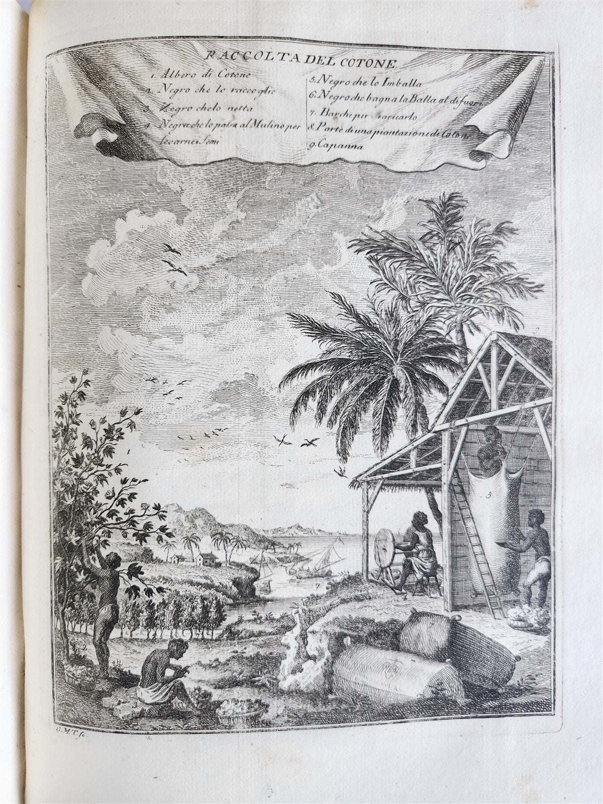
37 plates with views, animals, birds, plants, costumes, all copper-engraved , drawn from a variety of sources, richly illustrate this edition,
with scenes of Quebec, Niagara Falls, cod fishing in Newfoundland, New York, Boston, Santiago, Acapulco, Lima, Havana, Florida, St. Eustatius, and maps of the Great Lakes, Newfoundland, Hudson's Bay, New England, Jamaica, Barbados, and many other locales.
There are also images of American birds, animals, peoples, buildings, etc.
(the second volume lacks the index of illustrations and the map of Santo Domingo, otherwise very good interior).
Original half-vellum binding , title stamped in gold on the spine, sprayed edges.
Front hinge split
Ex libris by Count Giuseppe Martelli of Florence.
This impressive work offers a detailed description of the American territories including their geographical situation, climate, soil, natural productions, as well as their ancient and modern historical status
This edition is significantly improved over the English original and is highly prized not only for its beautiful typography but also for its numerous maps, including Jamaica, Martinique, Cuba, Canada, Venezuela, Florida, and plans and views of cities such as Acapulco, Havana, Santiago de Chile, Boston, Quebec, and New York.
Leclerc 233: “An important publication worthy of search for its numerous maps and prints.”
folio: 9.5 by 12.5"
Text in Italian
=========================